
Geometry plays a crucial role in Mars missions by helping you map the surface accurately, plan safe rover routes, and design durable landers. It guides satellite imaging, enabling precise location tracking and surface analysis. Engineers use geometric principles to create stable, efficient spacecraft. Understanding these shapes and angles improves mission safety and success, allowing you to interpret terrain and environmental data effectively. Keep exploring to discover how geometric innovations continue to shape Mars explorations.
Key Takeaways
- Geometric mapping enables detailed 3D terrain models for accurate navigation and landing site selection on Mars.
- Shape analysis assists in identifying impact craters, volcanic features, and mineral deposits for scientific exploration.
- Path planning algorithms optimize rover routes by analyzing terrain features and detecting obstacles in real-time.
- Precise coordinate systems and pattern recognition improve data interpretation and feature localization from satellite imagery.
- Geometric modeling enhances environmental simulations, ensuring mission safety, component durability, and successful surface operations.
Mapping the Martian Surface With Geometric Precision
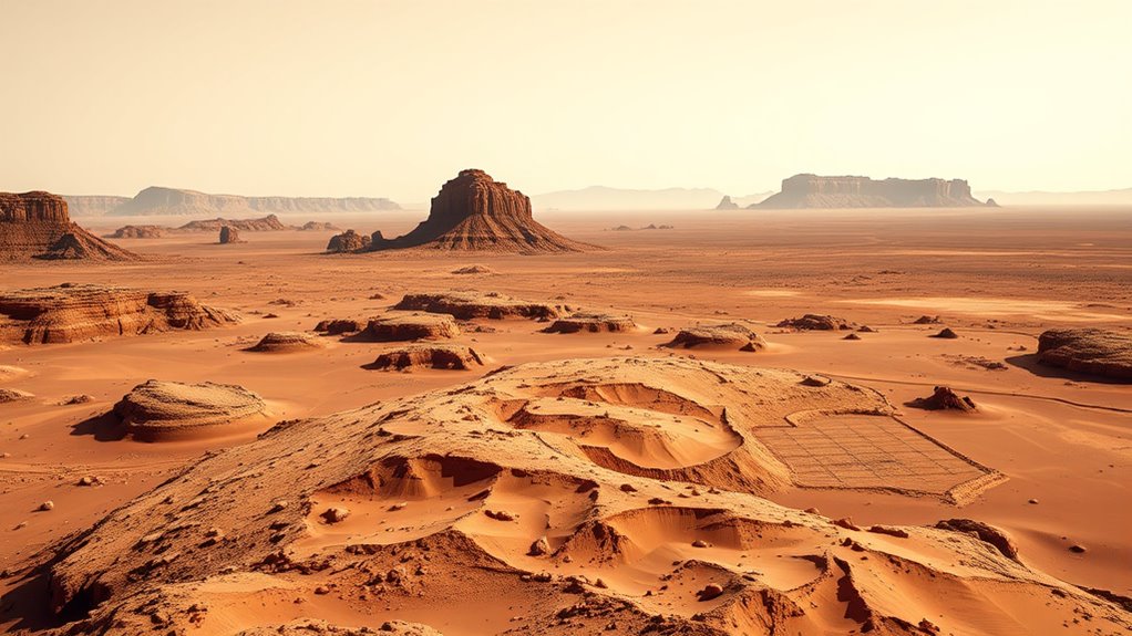
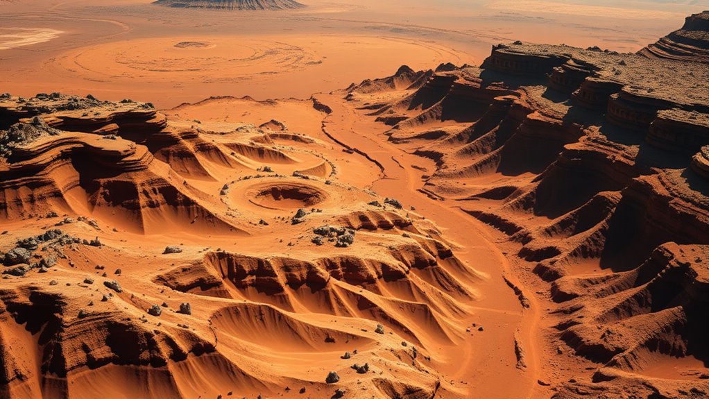
Advancements in imaging technology now allow scientists to map the Martian surface with unprecedented geometric accuracy. To achieve this, researchers use geometric modeling techniques that create detailed 3D representations of terrain features. Surface tessellation plays a vital role by dividing the landscape into small, manageable polygons, enabling precise analysis of the planet’s surface. This process helps identify key geological formations and monitor changes over time. By combining high-resolution images with advanced algorithms, you can generate accurate digital elevation models, revealing subtle surface variations. These detailed models are essential for understanding Mars’s geology and planning future missions. With geometric modeling and surface tessellation, you gain a clearer, more accurate picture of the Martian terrain, laying the groundwork for exploration and study. geometric modeling techniques enhance our ability to interpret complex surface data, leading to more informed decision-making in planetary exploration.
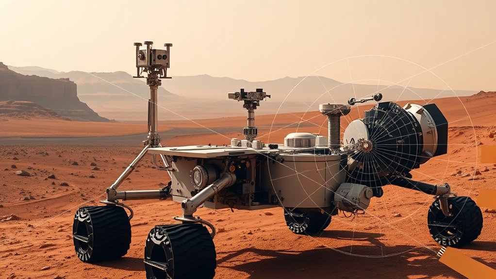
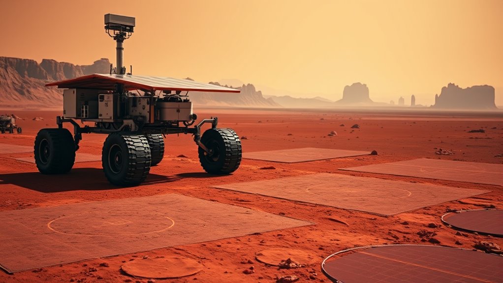
Navigating Rovers Using Geometric Algorithms
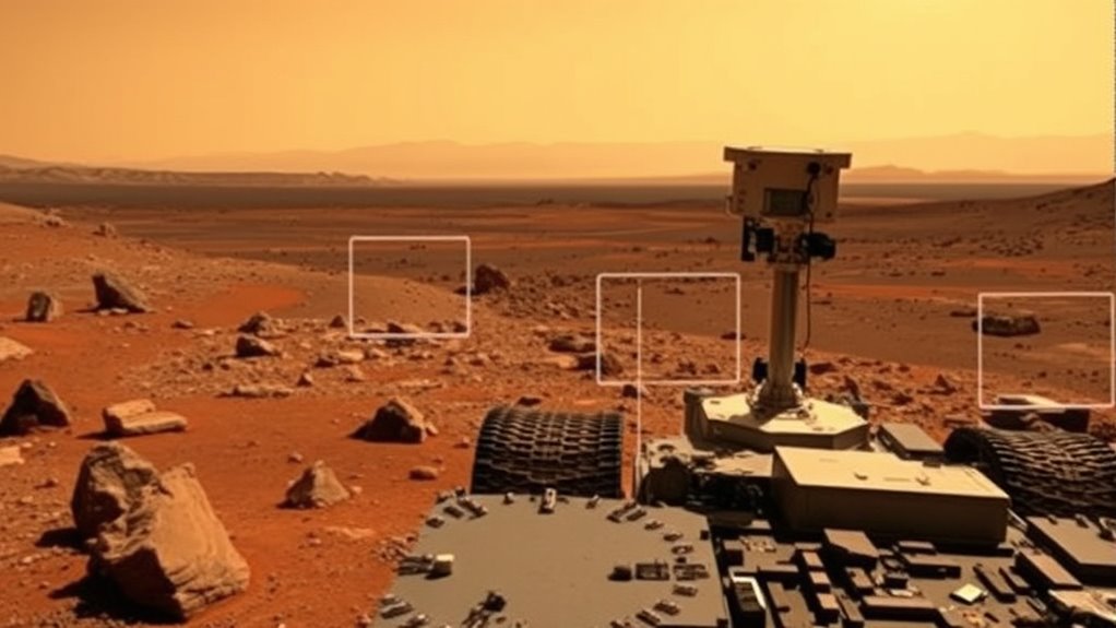
You can optimize rover movement by applying various path planning techniques that chart efficient routes across terrain. Obstacle avoidance strategies help you detect and navigate around hazards in real-time, ensuring safety and mission success. Understanding these geometric algorithms is key to improving rover autonomy on distant planets.
Path Planning Techniques
Have you ever wondered how rovers navigate the challenging terrain of distant planets? Path planning techniques rely heavily on geometric algorithms to chart safe routes. You use thermal imaging to identify hazards like hotspots or unstable ground, guaranteeing safe traversal. The rover’s onboard systems analyze this data, creating a geometric map of the surroundings. When approaching scientific targets, the robotic arm’s position and reach are factored into the route, avoiding obstacles and optimizing efficiency. These algorithms calculate the shortest, safest path by considering terrain features and the rover’s capabilities. By combining geometric modeling with real-time sensor data, you enable precise navigation across Mars’s unpredictable landscape. This approach ensures that your rover can explore new regions effectively, minimizing risks and maximizing scientific discoveries.
Obstacle Avoidance Strategies
Obstacle avoidance is a vital component of rover navigation, ensuring safe traversal through unpredictable terrains. You rely on geometric algorithms to detect obstacles and plan routes around them, preventing collisions. When approaching rough terrain, the rover uses its robotic arm for precise maneuvers, clearing small debris or adjusting equipment. During atmospheric analysis, the rover updates its path if dust storms or high winds threaten stability. Understanding heat pump technology is essential for optimizing energy efficiency and performance in various applications.
- You analyze terrain features with geometric modeling to identify safe passages
- Sensors help detect unexpected obstacles in real-time
- Algorithms reroute the rover to avoid hazards without halting progress
- The robotic arm aids in obstacle removal or terrain assessment for better navigation decisions
Satellite Imaging and Coordinate Systems on Mars
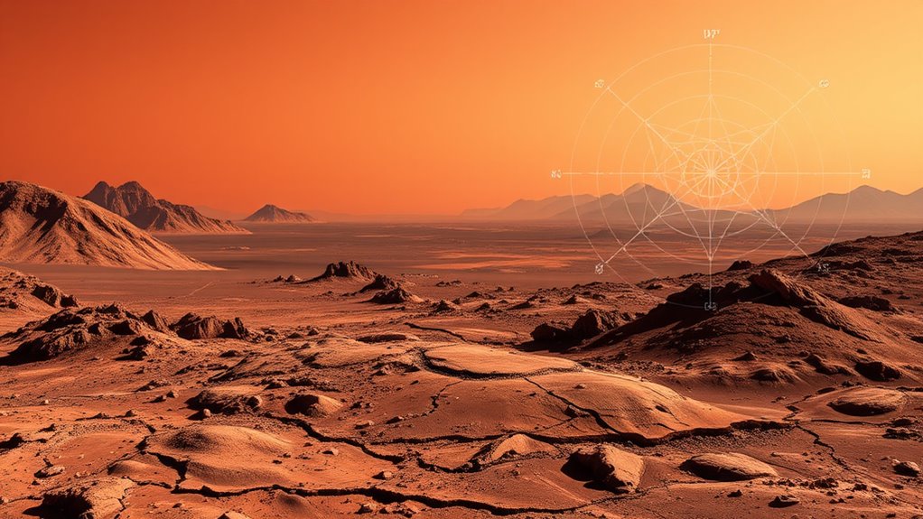
How do scientists precisely map and analyze the surface of Mars using satellite imaging? They rely on high-resolution images captured from orbit, which are then processed using specialized coordinate systems. These systems allow you to accurately locate features like craters and landforms, essential for crater analysis. By overlaying satellite data with topographic maps, you can identify surface variations and geological structures. Additionally, satellite imaging supports atmospheric modeling by tracking weather patterns and dust storms, helping you understand environmental conditions. Precise coordinate systems guarantee that all data aligns correctly, enabling detailed surface analysis. This combination of imaging and coordinate technology allows you to create accurate maps, plan exploration routes, and study Mars’s geology and atmosphere with confidence. The use of coordinate systems ensures that all data integration and analysis are consistent and reliable across different datasets and missions.
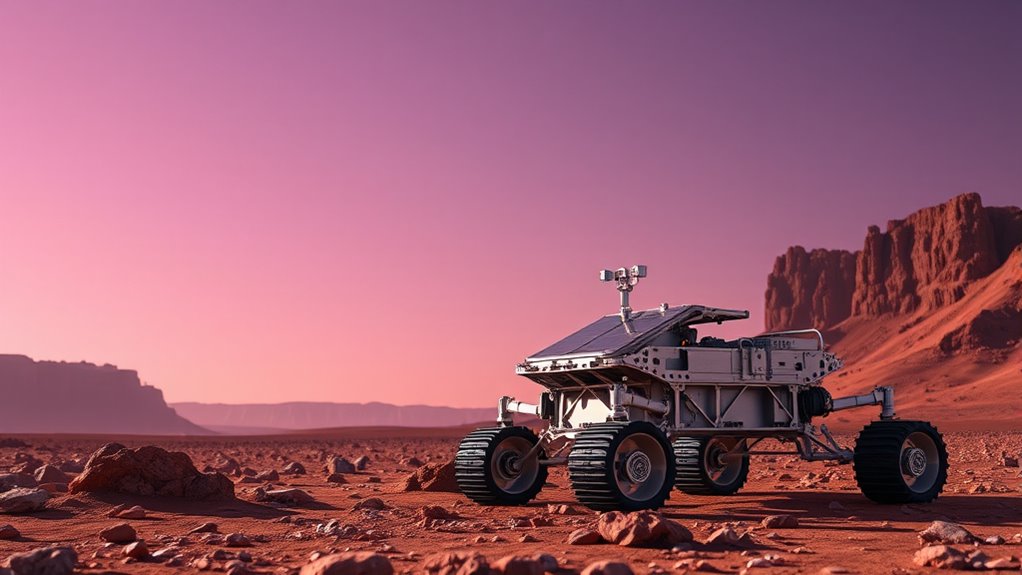
Planning Traverses: Route Optimization Through Geometry
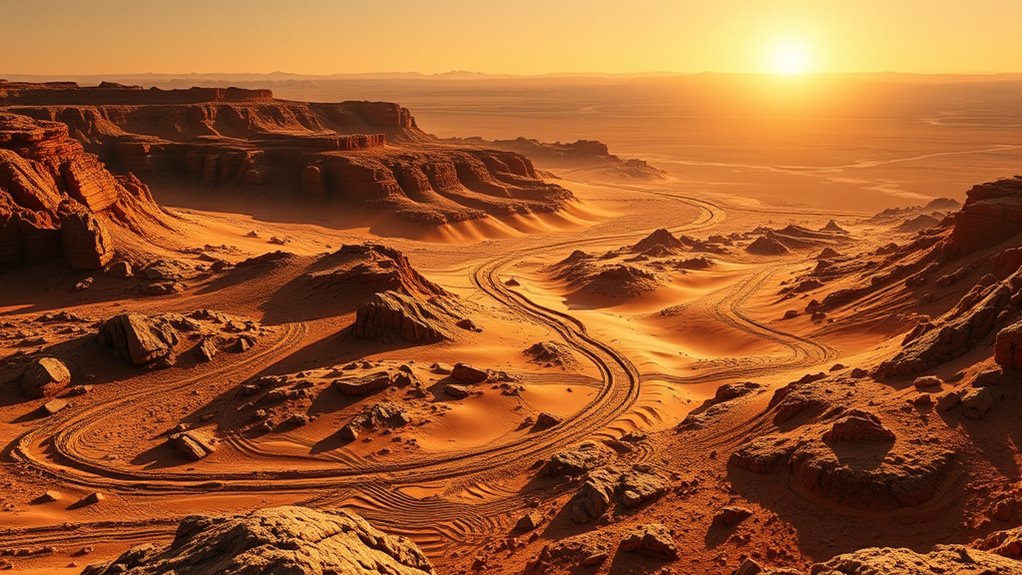
Ever wondered how explorers determine the most efficient routes across the Martian surface? They use geometry to optimize traverses by analyzing terrain features and minimizing travel distance. Geometric tessellations help in dividing large areas into manageable, repeating patterns, making route planning more systematic. Symmetry analysis identifies balanced paths, reducing energy use and avoiding hazards. By applying these techniques, you can create optimized routes that cut through obstacles and save time. These methods also allow for better terrain coverage, ensuring scientific objectives are met efficiently. Understanding geometric tessellations and symmetry analysis transforms complex terrain into manageable sections, simplifying navigation. Incorporating visualization tools can further enhance route planning by providing clear, detailed representations of the terrain. This approach enhances rover safety and efficiency, making sure each traverse is strategic, precise, and well-planned for success.
Analyzing Terrain Features With Geometric Shapes
You can identify terrain features by recognizing geometric shapes like circles, squares, and triangles in satellite images. These shape identification techniques help map out landforms accurately and efficiently. By understanding these shapes, you improve your terrain mapping strategies for better navigation and analysis. Additionally, recognizing geometric shapes in various landforms can aid in detecting natural or artificial structures during planetary exploration.
Shape Identification Techniques
Analyzing terrain features with geometric shapes enhances our ability to identify and interpret planetary surfaces efficiently. By recognizing specific shapes, you can classify craters, distinguishing those formed by impacts from volcanic ones. Shape identification also aids in mineral detection, as certain mineral deposits create unique geometric patterns. Techniques like edge detection and pattern recognition help you analyze satellite images quickly. You can identify circular craters, elongated ridges, or polygonal fractures, providing clues about geological processes. These methods improve surface analysis accuracy and speed, essential for planning rover paths or landing sites. Using geometric shape analysis, you gain critical insights into Mars’ history, surface composition, and potential resources, supporting more targeted exploration missions. Etsy Shops can leverage similar shape recognition techniques to categorize and optimize product listings.
Terrain Mapping Strategies
Utilizing geometric shapes to map terrain features allows for precise and efficient interpretation of planetary surfaces. By applying basic forms like circles, triangles, and rectangles, you can identify craters, ridges, and valleys with clarity. This approach simplifies complex landscapes, enabling you to analyze terrain through a lens of artistic expression, where shapes convey deeper meaning. Just as cultural symbolism uses symbols to communicate ideas, geometric mapping captures the essence of Mars’s surface features, making them easier to interpret. These shapes serve as visual tools, transforming raw data into understandable patterns. This strategy enhances your ability to navigate and plan exploration routes, ensuring that each feature’s geometric signature guides your understanding of Mars’s diverse and intriguing terrain. Creating visual clarity through geometric analysis is essential for effective terrain mapping in space exploration.
Engineering Mars Landers: Geometric Design Considerations
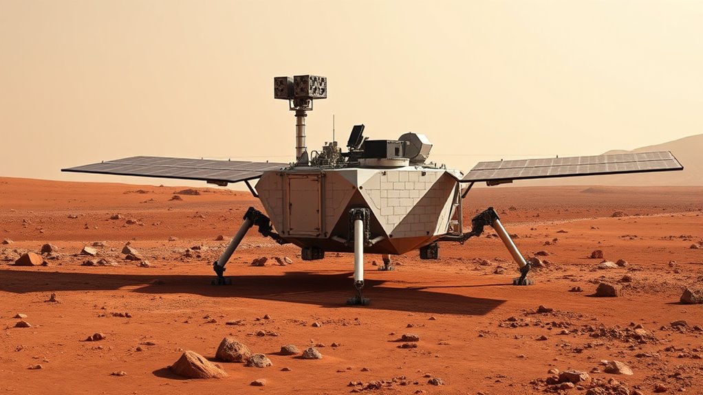
Designing Mars landers requires careful attention to their geometric shape to guarantee stability, durability, and functionality upon landing. The shape influences how the lander absorbs impact and maintains balance on uneven terrain. You must consider the placement of key components like the robotic arm, ensuring it can extend without risking tipping. Thermal insulation plays a crucial role in protecting sensitive electronics from extreme temperatures, often incorporated into the lander’s exterior geometry. You’ll also need to optimize the lander’s base for stability, especially on loose or rocky surfaces. Proper geometric design helps distribute forces evenly during descent, reducing damage risk. Overall, a well-thought-out shape ensures the lander performs its scientific and operational tasks effectively once on Mars’s surface. Additionally, selecting appropriate materials for the lander’s exterior can improve durability and thermal regulation under Martian conditions.
Data Interpretation: Applying Geometry to Martian Data Sets
By applying geometric principles to Martian data sets, you can uncover meaningful patterns and insights that might otherwise remain hidden. For example, analyzing the angles and distances between atmospheric measurements helps determine how Mars’s atmospheric composition varies with altitude. Geometry also aids in understanding cosmic radiation exposure by mapping radiation levels across different regions. Precise measurements of data points reveal correlations between dust storms and atmospheric density, informing rover navigation and safety. Use the table below to see how geometric tools assist in data interpretation:
| Data Type | Geometric Application |
|---|---|
| Mars atmospheric data | Triangulation of atmospheric layers |
| Cosmic radiation | Mapping radiation intensity across zones |
| Surface features | Measuring angles for topographical mapping |
| Dust storm patterns | Analyzing movement trajectories |
| Rover positioning | Calculating precise locations |
Additionally, understanding the measurement techniques used in collecting Martian data enhances the accuracy of geometric analyses and supports successful mission planning.
Future Technologies: Geometric Innovations in Space Exploration
Advancements in geometric technologies are revolutionizing space exploration, enabling more precise navigation, mapping, and data analysis. These innovations incorporate cultural symbolism and artistic representations, making space tools more intuitive and meaningful. You might see geometric patterns inspired by ancient symbols, blending science with cultural storytelling. Future tech includes adaptive geometric algorithms that improve spacecraft stability and surface analysis. These innovations help interpret planetary landscapes through artistic representations, enhancing understanding and engagement. Geometric innovations also foster new design approaches, combining functionality with aesthetic appeal. You’ll notice how cultural symbolism influences the shapes and structures used in space tech, creating a connection between human history and exploration. Additionally, the integration of home furnishings concepts like mattress toppers and heated pads demonstrates how comfort and ergonomic design principles inspire innovative solutions in space habitats. These developments promise not only technological progress but also a richer, culturally aware approach to space missions.
The Impact of Geometric Understanding on Mission Success
How does a deep understanding of geometric principles directly influence the success of space missions? It allows you to accurately interpret data, navigate complex terrains, and predict how objects will behave in space. Recognizing geometric illusions helps avoid visual misjudgments, guaranteeing precise landings and operations. Mathematical modeling, rooted in geometry, enables you to simulate environments and plan maneuvers confidently. For example, understanding the geometry of Mars’s surface guides rover paths and resource placement. Here’s a simple comparison:
| Geometric Illusions | Mathematical Modeling |
|---|---|
| Can mislead visual estimates | Ensures accurate predictions |
| Important in visual perception | Critical for mission planning |
| Requires careful analysis | Based on precise calculations |
Understanding spatial awareness is also essential for ensuring safety and success in space exploration.
Frequently Asked Questions
How Does Geometry Improve Communication Between Earth and Mars Spacecraft?
You can see that geometry improves communication between Earth and Mars spacecraft through precise satellite alignment and orbital synchronization. By calculating the correct angles and positions, you guarantee signals travel efficiently without delays or interruptions. This careful planning allows spacecraft to maintain ideal contact with ground stations, making data transfer smoother and more reliable. Fundamentally, geometry helps you coordinate the complex dance of satellite movements, keeping the lines of communication open across millions of miles.
What Geometric Techniques Help Detect Subsurface Water on Mars?
You can use geometric techniques like subsurface mapping and water detection methods to find water beneath Mars’ surface. These techniques analyze data from radar and imaging instruments, helping you identify features indicating water presence. By applying geometric principles, you interpret subsurface structures and locate water-rich areas more accurately. This approach enhances your ability to detect subsurface water, vital for understanding Mars’ geology and potential habitability.
How Are Geometric Models Used in Predicting Mars Weather Patterns?
Imagine you’re a Martian meteorologist in 2060, using satellite triangulation to predict weather patterns. You rely on geometric models that incorporate topographic mapping to understand how terrain influences atmospheric flow. These models help forecast dust storms and temperature changes, guiding explorers safely. By analyzing spatial relationships, you can anticipate weather shifts, making your predictions more accurate and ensuring mission success on the Red Planet.
What Role Does Geometry Play in Designing Mars Habitats?
You use geometry to design Mars habitats by guaranteeing structural integrity and optimizing interior spatial planning. Geometric principles help you create strong, stable structures that withstand Mars’ harsh conditions. You carefully layout interior spaces, maximizing functionality and safety while minimizing material use. This precise application of geometry ensures your habitat is both durable and efficient, providing a safe environment for explorers and supporting their needs on the Red Planet.
Can Geometric Algorithms Assist in Identifying Potential Mineral Deposits?
Imagine you’re analyzing Mars surface data and want to find mineral deposits. Geometric algorithms can help with mineral detection by processing geospatial analysis, identifying patterns, and mapping potential mineral-rich areas. For example, a hypothetical algorithm could analyze satellite imagery, highlighting zones with specific geometric features linked to mineral presence. This approach streamlines exploration, making it easier to target promising sites and plan future missions efficiently.
Conclusion
Your grasp of geometry truly shapes our journey to Mars. It’s the backbone that guides our rovers, maps the surface, and guarantees safe landings. Without it, steering the Red Planet’s maze would be like sailing uncharted waters without a compass. As technology advances, your understanding of geometric principles will keep pushing boundaries, turning complex challenges into stepping stones. Geometry isn’t just a tool; it’s the heartbeat of every successful mission, guiding us home.