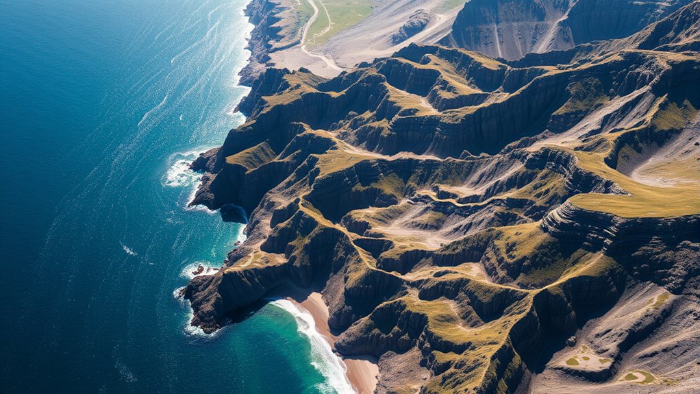

You can see that mountains and coastlines display self-similar, fractal patterns, meaning their shapes look similar whether you zoom in or out. These structures form through natural processes like erosion, which continuously sculpt the terrain at multiple scales. Fractal geometry explains how complex landscape features follow mathematical principles, revealing underlying natural laws. By exploring these patterns further, you’ll discover how Earth’s features are more ordered and interconnected than they seem on the surface.
Key Takeaways
- Mountains and coastlines exhibit self-similar, fractal patterns across multiple scales due to natural erosion processes.
- Erosion by wind, water, and ice shapes jagged coastlines and rugged mountain profiles, reinforcing fractal complexity.
- River networks and branching channels display fractal geometry, illustrating self-similar patterns in landscape formation.
- Fractal analysis helps explain the consistent, intricate structures of natural landscapes, reflecting underlying geological and erosional laws.
- Recognizing fractal patterns in landscapes enhances understanding of Earth’s dynamic geological processes and natural beauty.
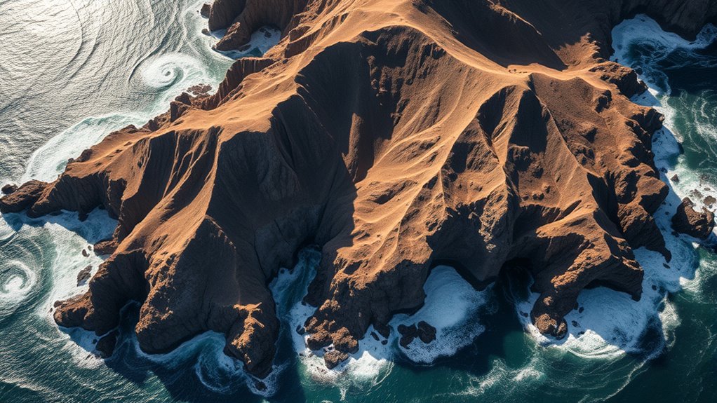
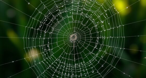
Have you ever wondered why coastlines, mountain ranges, and river networks appear so complex and seemingly irregular? The answer lies in the fascinating world of fractal geometry. These natural features display self-similarity patterns, meaning their structures look similar at different scales. When you look at a coastline from afar, it appears jagged and intricate. Zoom in closer, and you’ll see smaller, similar patterns repeating along its edge. This recursive pattern is a hallmark of fractals, revealing that the landscape’s complexity isn’t random but governed by underlying mathematical principles. Similarly, mountain ranges exhibit rugged profiles that maintain their roughness whether viewed from miles away or up close. This self-similarity isn’t accidental; it results from a combination of natural processes shaping the terrain over time.
Erosion processes play a *fundamental* role in creating and maintaining these fractal patterns. As wind, water, and ice act upon the landscape, they carve out features at various scales, perpetuating the self-similar structures. For coastlines, wave action gradually erodes softer rock, creating irregular, jagged edges. Over time, these erosional forces produce a coastline with a fractal dimension that reflects its complexity. Mountain ranges, on the other hand, form through tectonic activity combined with erosional sculpting. As mountains rise, erosion wears them down unevenly, accentuating their ruggedness and maintaining the fractal-like roughness. River networks weave through terrains, following paths that often display branching patterns similar to fractals. These networks develop through erosion and sediment transport, carving out channels that branch repeatedly, creating a self-similar pattern observable at multiple scales.
Understanding the fractal nature of landscapes helps explain why their appearances remain consistent regardless of the scale at which you observe them. It’s not mere chaos; it’s a product of natural laws and processes that operate across various levels. Erosion processes, in particular, are *essential* in reinforcing these patterns by continuously reshaping the terrain in ways that preserve their fractal characteristics. The interplay between geological activity and erosional forces results in landscapes that are both complex and mathematically elegant. This fractal perspective allows scientists to analyze and predict terrain features more accurately, offering insights into the dynamic processes that shape our planet. So, when you gaze at a mountain range or a rugged coastline, remember that what you see isn’t just randomness but a manifestation of nature’s intrinsic fractal order.
Frequently Asked Questions
How Do Fractals Influence Climate Patterns in Mountainous Regions?
Fractals influence climate patterns in mountainous regions by shaping how air flows and moisture moves. You’ll notice that fractal snowflakes and mountain ridgelines create complex, recursive patterns that impact local weather. These fractal structures cause turbulence and uneven temperature distribution, leading to varied precipitation and microclimates. By understanding these patterns, you can better predict weather changes and how climate interacts with the rugged landscape, making your insights more precise.
Can Fractal Analysis Predict Erosion Rates on Coastlines?
Imagine coastline patterns as a tangled web, where each thread reflects erosion processes. Fractal analysis helps you understand this web, revealing complex patterns in coastal sediment dynamics. You can use it to improve erosion modeling, predicting how coastlines change over time. By analyzing the fractal dimensions, you gain insights into erosion rates, enabling proactive measures to protect coastlines from future degradation.
What Tools Are Best for Measuring Fractal Dimensions in Landscapes?
You should use remote sensing tools like satellite images or aerial photographs to measure fractal dimensions in landscapes. The box counting method is highly effective for this purpose, allowing you to analyze the complexity of terrain features. By applying these techniques, you can accurately quantify landscape roughness and scale, helping you understand erosion patterns and landscape evolution more precisely. Combining remote sensing with box counting gives you a powerful approach to landscape analysis.
Are Fractal Patterns Unique to Specific Geographic Areas?
Think of fractal patterns as fingerprints—they can vary, but aren’t entirely unique to each place. In landscapes, you’ll find some patterns with high geographic variability, while others show pattern specificity. So, fractal patterns aren’t strictly unique to specific areas; instead, they reflect the underlying processes shaping the terrain. Your analysis reveals similarities and differences, helping you understand how geography influences landscape complexity.
How Do Fractals Affect Biodiversity in Mountain Ecosystems?
Fractals increase biodiversity in mountain ecosystems by creating complex habitats that support diverse species. You’ll find that the intricate patterns of terrain, like rugged slopes and varied vegetation, boost habitat complexity. This diversity offers more niches, allowing different species to thrive. So, by shaping landscapes with fractal geometry, you enhance species diversity and promote a richer, more resilient ecosystem.
Conclusion
By now, you see how fractal geometry reveals the intricate patterns of mountains and coastlines. It’s fascinating to realize that these seemingly chaotic landscapes follow underlying mathematical rules. Isn’t it amazing that nature’s complexity can be described with simple formulas? As you observe the world around you, remember that every jagged cliff and winding shoreline reflects the beauty of fractal patterns. Isn’t nature’s design truly a masterpiece of mathematics?