
You might think the Earth is a perfect sphere, but it’s actually an oblate spheroid. This means it’s slightly flattened at the poles and bulges at the equator because of its rotation and gravity. Satellite images and scientific measurements show this shape clearly. Understanding this shape is important for navigation and tracking changes on Earth’s surface. Keep exploring, and you’ll discover even more fascinating details about what makes our planet unique.
Key Takeaways
- Earth is an oblate spheroid, slightly flattened at the poles and bulging at the equator.
- Satellite imagery visually confirms Earth’s oblate shape, showing equatorial bulging.
- Gravity and rotation cause Earth’s shape, resulting in an equatorial diameter about 43 km larger than pole-to-pole.
- Modern measurements and satellite data provide precise evidence of Earth’s oblate form.
- Understanding Earth’s shape is essential for accurate navigation, mapping, and monitoring environmental changes.
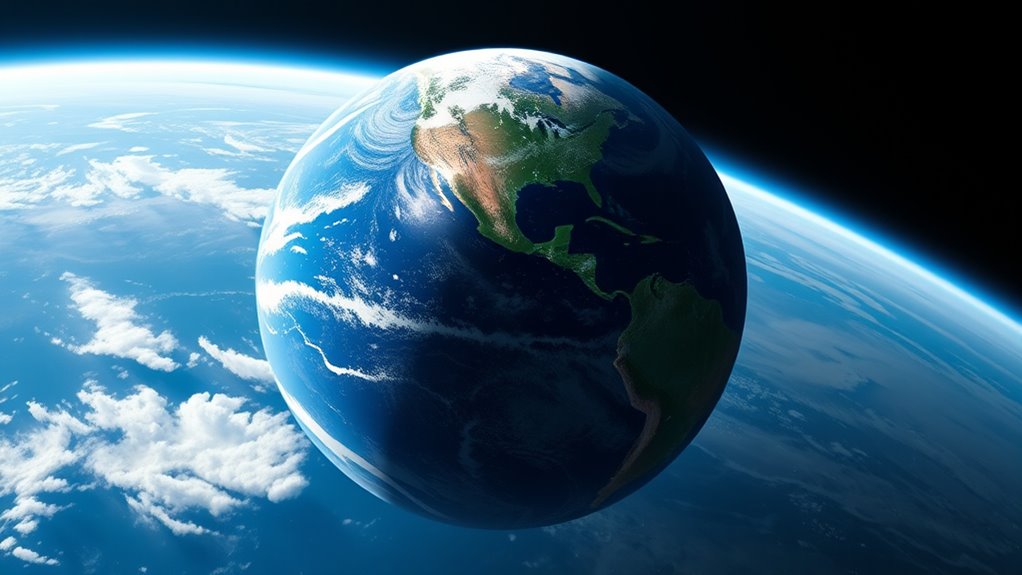
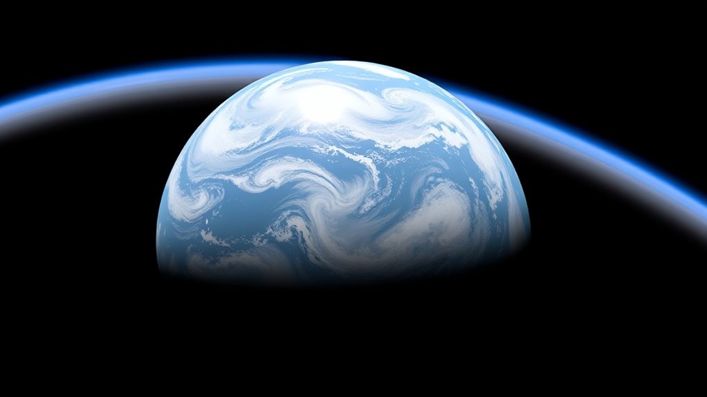
Have you ever wondered what shape the Earth really is? It’s a question that has fascinated humans for centuries. When you look at the horizon or watch ships disappear behind the curve, it might seem obvious that the Earth is round. But scientists have gone beyond simple observation to understand its true shape. Today, they know that Earth isn’t a perfect sphere but an oblate spheroid—a sphere slightly flattened at the poles and bulging at the equator. This shape results from Earth’s gravity and rotation, which cause the planet to stretch out at the middle. Thanks to advances in satellite imagery, we now have detailed visual evidence confirming this shape. Satellites orbiting Earth capture images that clearly show the slight flattening at the poles and the equatorial bulge. These images are powerful tools for scientists, providing precise measurements that help us understand Earth’s form better than ever before. satellite imagery plays a crucial role in visualizing these subtle differences and confirming the planet’s oblate shape.
Earth’s gravity plays a *vital* role in shaping the planet. Because of its rotation, the force of gravity pulls matter toward the center, but the centrifugal force from rotation causes a slight outward push at the equator. This interplay results in Earth being an oblate spheroid. Satellite data has confirmed that the equatorial diameter is about 43 kilometers (27 miles) larger than the pole-to-pole diameter. This difference might seem small, but it’s significant enough to be measured with modern technology. Satellite imagery helps scientists analyze these subtle variations in Earth’s shape, providing visual proof that the planet isn’t a perfect sphere. These images also facilitate detailed mapping and navigation systems, allowing for more accurate GPS readings and geographical measurements.
Understanding Earth’s shape isn’t just academic; it impacts everyday life. For example, GPS systems rely on satellite data that accounts for the planet’s oblate shape to provide precise locations. Without considering Earth’s true form, navigation could be inaccurate, especially over long distances. Satellite imagery also helps track changes in Earth’s shape over time, revealing how factors like tectonic activity and melting ice caps influence our planet’s structure. This constant monitoring gives us a clearer picture of Earth’s dynamic nature. So, the next time you look at a satellite image of Earth, remember that this visual evidence confirms what scientists have known for centuries: our planet is a slightly flattened sphere, shaped by the interplay of gravity and rotation. It’s a fascinating reminder of how scientific advances continue to deepen our understanding of the world we live on.
Frequently Asked Questions
How Does Earth’s Shape Affect Climate Patterns Worldwide?
Your understanding of Earth’s shape helps explain climate patterns worldwide. Due to latitude variations, the shape causes different areas to receive varying amounts of sunlight, creating distinct climate zones. Near the equator, you’ll find tropical climates, while higher latitudes experience colder, polar conditions. This variation influences weather, ecosystems, and agriculture, showing how Earth’s oblate spheroid shape directly shapes climate zones and impacts your environment.
Can Satellite Images Conclusively Prove Earth’s Shape?
Satellite images, combined with satellite verification and image analysis, can strongly support Earth’s shape as an oblate spheroid. While these images don’t provide absolute proof alone, they offer clear visual evidence of Earth’s curvature and shape. When you analyze satellite data, you see consistent curvature patterns that align with scientific understanding, making it highly convincing. So, yes, satellite verification and image analysis make a compelling case for Earth’s shape.
What Role Does Gravity Play in Earth’s Oblate Form?
Gravity plays a key role in shaping Earth’s oblate form by creating a gravitational pull that pulls matter toward the center. This causes the equatorial bulge, where the planet’s diameter is slightly larger at the equator than at the poles. The centrifugal force from Earth’s rotation also contributes, making the planet slightly flattened at the poles and wider at the equator, resulting in its oblate spheroid shape.
Do Ancient Civilizations Recognize Earth’s Shape Differently?
Imagine wandering through ancient skies, where civilizations saw Earth as a flat disk or a grand temple’s roof, shaped by their beliefs. In ancient cosmology and historical geography, many cultures didn’t recognize Earth as an oblate spheroid but saw it differently—flat, circular, or even as a divine vessel. Their understanding was rooted in observation and myth, shaping their worldviews and stories about the cosmos.
How Does Earth’s Shape Influence Navigation and GPS Accuracy?
Your understanding of Earth’s shape is vital for navigation and GPS accuracy. Since Earth is an oblate spheroid, geodesic calculations must account for its flattened poles and bulging equator. Ignoring this can lead to navigation errors, making your routes less precise. By considering Earth’s actual shape, technology guarantees accurate positioning, helping you reach destinations efficiently and safely, whether you’re sailing, flying, or exploring new areas.
Conclusion
So, next time you look up, remember that the Earth isn’t a perfect sphere. It’s an oblate spheroid, slightly flattened at the poles. In fact, the Earth’s diameter at the equator is about 43 kilometers larger than from pole to pole. This subtle shape affects everything from satellite orbits to climate patterns. Understanding this shape helps you see our planet as a dynamic, slightly squished sphere, constantly in motion and shape.