
TL;DR
Prime for Young Adults — start your free trial
Fast free delivery, streaming and member deals for eligible 18–24 year olds.
Try it freeAs an affiliate, we earn on qualifying purchases.
French firefighters have reported their first encounter with a pyrocumulonimbus cloud during ongoing wildfires. This rare atmospheric phenomenon indicates extreme fire conditions and has implications for firefighting strategies and safety.
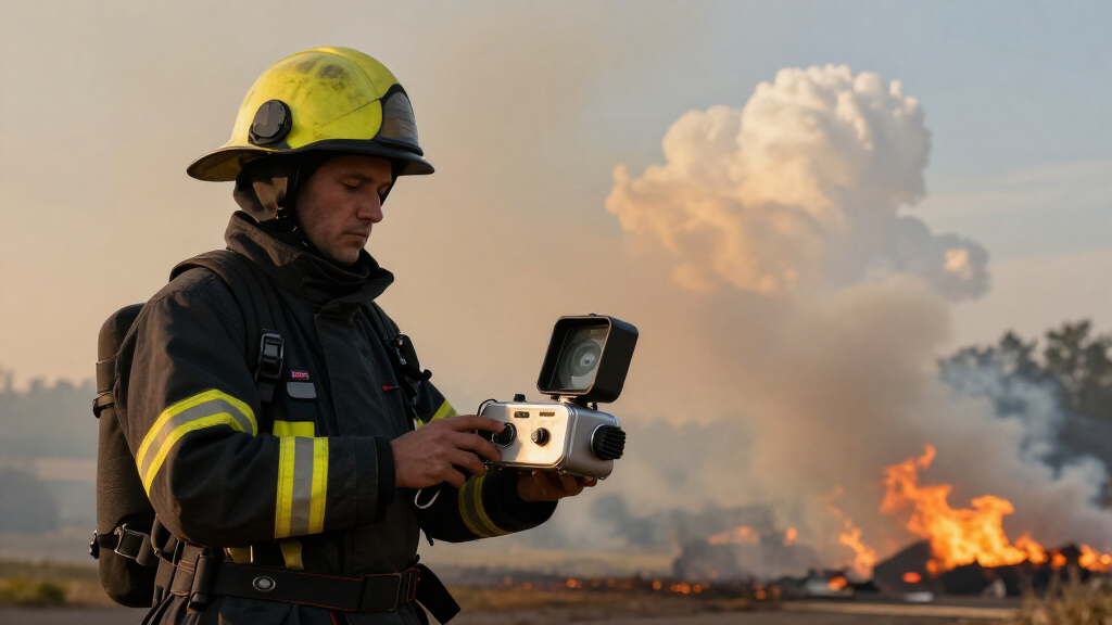
French firefighters have reported their first-ever encounter with a pyrocumulonimbus cloud, a rare and intense atmospheric phenomenon associated with extreme wildfires, during current wildfire emergencies in southeastern France. This development highlights the severity of the ongoing fires and raises concerns about fire behavior and safety.
The incident occurred as multiple wildfires intensified in the Provence-Alpes-Côte d’Azur region, prompting firefighting efforts that revealed the formation of a pyrocumulonimbus cloud. According to local authorities, this type of cloud is formed by intense heat from large fires causing air to rise rapidly, creating a thunderstorm-like cloud capable of generating lightning and strong winds. Fire officials confirmed the occurrence through aerial observations and weather data.
Experts describe pyrocumulonimbus as a rare phenomenon usually associated with large, uncontrollable fires or volcanic eruptions. The French fire service noted that this is the first documented case in France where such a cloud has been observed during wildfire events, marking a significant milestone in fire behavior observation in the region.
Implications of Pyrocumulonimbus Formation in France
The formation of a pyrocumulonimbus cloud signifies extreme fire conditions, including rapid fire spread, unpredictable behavior, and increased risk of lightning-induced new fires. For firefighters, this presents heightened safety challenges and complicates suppression efforts. The occurrence also underscores the increasing severity of wildfires linked to climate change, which can produce more intense and unpredictable fire phenomena.
Furthermore, the development of such clouds can influence local weather patterns, potentially leading to more erratic and dangerous fire behavior. This event draws attention to the need for improved fire prediction models and safety protocols in wildfire management.
As an affiliate, we earn on qualifying purchases.
Historical and Regional Context of Pyrocumulonimbus Events
Pyrocumulonimbus clouds, often called ‘fire thunderstorms,’ are rare phenomena typically associated with large-scale wildfires or volcanic activity. They have been documented in regions such as Australia, Canada, and the western United States during extreme fire seasons. In Europe, such occurrences are uncommon, with this being the first confirmed case in France. Experts have linked the increasing frequency of such events to the intensification of wildfires driven by climate change, which leads to hotter, drier conditions conducive to extreme fire behavior.
Historically, pyrocumulonimbus formation has been considered a sign of a fire reaching an uncontrollable stage, often leading to erratic weather conditions that can exacerbate fire spread and difficulty in firefighting. The recent event in France marks a new chapter in regional fire behavior observations and highlights the potential for more such phenomena as climate patterns evolve.
“This is the first time we have documented a pyrocumulonimbus cloud forming during a wildfire in France. It indicates how extreme the current fire conditions are.”
— Jean Dupont, French Fire Service Official
As an affiliate, we earn on qualifying purchases.
Uncertainties About Future Fire Behavior and Risks
It is still unclear how frequently pyrocumulonimbus clouds will form in France or other parts of Europe as climate change progresses. The long-term impact of such phenomena on regional fire regimes and weather patterns remains under study. Additionally, the precise conditions that led to this specific event are still being analyzed, and whether similar occurrences will become more common is uncertain.
fire-resistant gloves for firefighters
As an affiliate, we earn on qualifying purchases.
As an affiliate, we earn on qualifying purchases.
Monitoring and Preparing for Extreme Fire Events
Authorities and scientists plan to closely monitor fire behavior and atmospheric conditions during ongoing wildfire seasons. Research into pyrocumulonimbus formation and its predictors is expected to expand, aiming to improve early warning systems. Fire agencies are reviewing safety protocols to account for the risks associated with such phenomena, and international collaboration may increase to better understand and mitigate these extreme fire events.
firefighting helmet with face shield
As an affiliate, we earn on qualifying purchases.
As an affiliate, we earn on qualifying purchases.
Key Questions
What is a pyrocumulonimbus cloud?
A pyrocumulonimbus cloud is a thunderstorm cloud formed by intense heat from a wildfire or volcanic eruption, capable of producing lightning, strong winds, and further ignitions.
Why is the formation of such a cloud significant?
It indicates extremely intense fire conditions, increased unpredictability, and potential for additional fires caused by lightning or wind gusts associated with the cloud.
Has this phenomenon been observed before in France?
This is the first documented case of a pyrocumulonimbus cloud forming during a wildfire in France, according to local authorities and fire experts.
What are the safety concerns for firefighters?
Pyrocumulonimbus clouds can produce lightning and erratic winds, which pose serious risks to firefighting personnel and complicate suppression efforts.
Will such events become more common?
Scientists believe climate change may increase the frequency of extreme fire phenomena, including pyrocumulonimbus clouds, but precise predictions are still under research.
Source: hn
Fall yard work Picks
leaf blowers
As an affiliate, we earn on qualifying purchases.