
In land surveying, “closing the loop” means ensuring your series of measurements start and end at the same point, creating a precise network. You measure angles and distances, then check for discrepancies between your calculated and actual positions. Proper loop closure helps identify and correct errors, making your data reliable. Using tools like total stations and applying correction methods like least squares adjustment, you can achieve accurate results—if you want to learn more about how it’s done, keep exploring.
Key Takeaways
- Traverses are sequences of connected points measured to define land boundaries and property lines accurately.
- Loop closure checks the discrepancy between the measured start and end points of a traverse.
- Errors detected during loop closure are corrected using adjustment methods like least squares adjustment.
- Proper closure ensures measurement consistency, minimizes errors, and validates survey data integrity.
- Accurate loop closing involves high-quality tools, environmental considerations, and systematic error correction.
What Is a Traverse in Land Surveying?
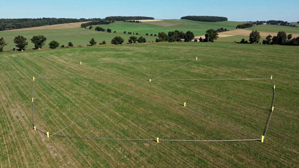
Have you ever wondered how surveyors determine property boundaries or map out land? It all starts with understanding what a traverse is. In land surveying, a traverse is a series of connected points measured through surveying fundamentals. These points form a path that helps surveyors map out land accurately. Land measurement techniques involve establishing precise angles and distances between points, which are then used to create a detailed layout of the property. Traverses are essential because they help in establishing boundaries, ensuring measurements are consistent and dependable. By carefully recording each point and connection, surveyors can precisely define property lines, detect overlaps, or gaps. High-precision measurement techniques are fundamental to achieving accurate results in land surveying processes. Additionally, traverse adjustments are often performed to correct any measurement errors and ensure the overall accuracy of the survey. This systematic approach makes traverses a crucial tool in land measurement and boundary determination, helping to maintain measurement accuracy throughout the surveying process. Properly conducting and analyzing traverses also involves understanding closure errors, which are discrepancies that need to be addressed to improve the survey’s reliability.
How Are Traverses Measured in Land Surveying?
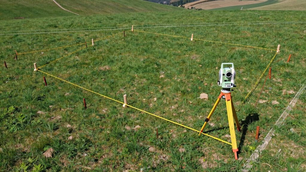
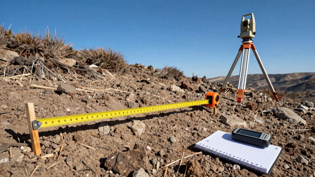
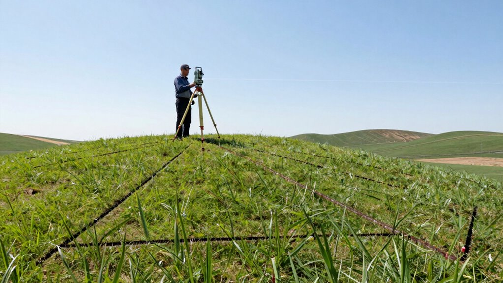
Ever wondered how surveyors accurately measure traverses in land surveying? The process begins with precise measurements of angles and distances between points. Using survey equipment like total stations, you record data that forms the basis of your traverse. To verify accuracy, coordinate adjustments are applied, which correct small measurement errors and align the data with known reference points. This step helps detect inconsistencies early, enabling error detection and correction before finalizing the traverse. You then analyze the data to check for loop closure, confirming that the measurements connect back to the starting point. By carefully performing coordinate adjustments and monitoring for discrepancies, you guarantee that your traverse data is reliable, accurate, and ready for use in mapping and boundary determination. Incorporating measurement precision techniques can further improve the reliability of your survey results. Implementing quality control procedures ensures that the data remains consistent and trustworthy throughout the process. Integrating innovative cloud technology can further enhance data security and accessibility throughout the surveying process. Applying error correction methods helps ensure the measurement accuracy of your measurements and overall survey quality.
What Are Common Errors in Traverse Loop Closure and How Can You Fix Them?
When performing a traverse loop closure, surveyors often encounter errors that can compromise the accuracy of their measurements. Common errors include misreading distances, angles, or instrument setup mistakes. To guarantee reliable results, error detection techniques are essential—checking for inconsistent measurements or deviations from expected values helps identify issues early. Additionally, understanding the principles of Free Floating can assist in recognizing and compensating for systematic errors. Once errors are detected, correction techniques like adjusting measurements through least squares adjustment or applying known correction factors can help fix inaccuracies. Regularly verifying instrument calibration and using redundant measurements also minimize errors. Incorporating error detection methods such as statistical analysis can further enhance the reliability of measurements. Recognizing the importance of Measurement Accuracy ensures that survey data meets precision standards. Implementing quality control procedures throughout the surveying process is vital for maintaining high standards. Moreover, employing systematic checks ensures that error accumulation is minimized over complex traverses. By systematically applying error detection and correction techniques, you can improve the precision of your traverse closure, ensuring your survey results are accurate and trustworthy.
Why Is Closing the Loop Important for Survey Accuracy?
Why is closing the loop essential for survey accuracy? When you close the loop, you verify that your measurements are consistent, minimizing errors. This process plays a key role in error correction and ensures the overall accuracy of your survey. Here’s why it matters:
- Detects discrepancies between the starting and ending points.
- Helps identify systematic errors that may have crept in.
- Confirms the reliability of your data before finalizing the survey.
- Net worth of survey data is maintained by verifying the integrity of measurements, ensuring that the results are trustworthy. Additionally, understanding support breakfast options can help surveyors plan for community engagement and local hospitality considerations. Recognizing cultural diversity in team members can also improve communication and project cohesion during survey operations. Being aware of regional error detection techniques can further enhance the accuracy and reliability of your survey process.
What Tools and Techniques Help Ensure Proper Loop Closure?
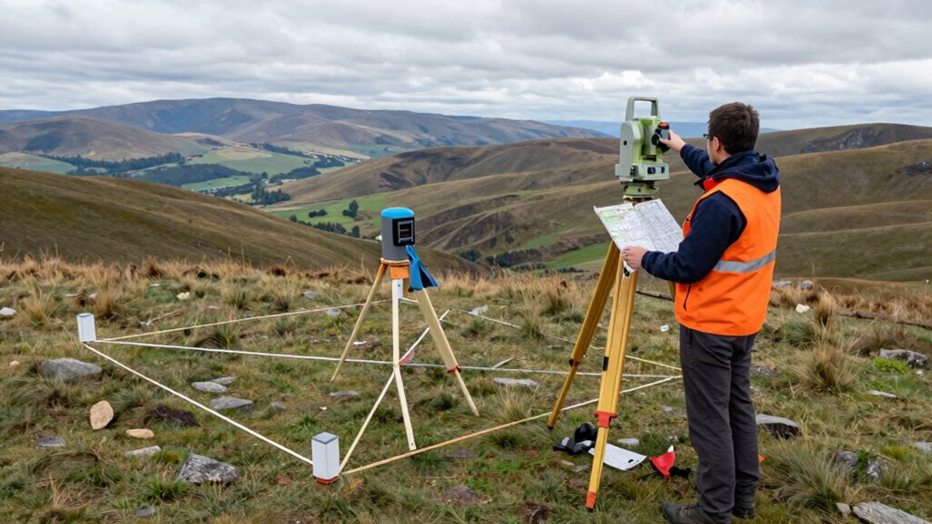
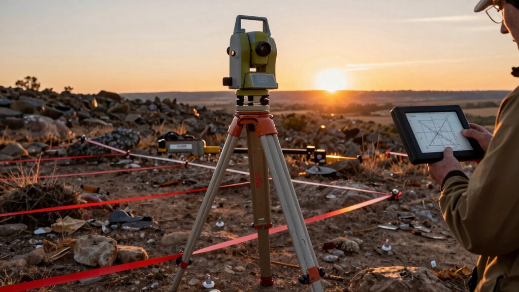
To guarantee proper loop closure, surveyors rely on a combination of precise tools and effective techniques. Accurate measurements depend on high-quality equipment like total stations and GPS devices, which reduce errors from the start. Survey data validation is vital; you check measurements for consistency and accuracy before finalizing the loop. data validation ensures the reliability of your measurements and helps identify discrepancies early. Precision adjustment techniques, such as least squares adjustment, help refine your data, balancing discrepancies across the traverse. These methods ensure your measurements align within acceptable tolerances. Employing these tools and techniques minimizes errors and enhances the reliability of your survey results, making certain that your traverse properly closes and that your data remains trustworthy. Proper loop closure ultimately hinges on meticulous data validation and the application of effective adjustment methods. Additionally, understanding wave and wind influences can help surveyors account for environmental factors that might affect measurements, ensuring that environmental conditions are properly considered during data collection. Recognizing atmospheric conditions can further improve measurement accuracy, especially over long distances or in challenging environments. Furthermore, staying aware of instrument calibration practices helps maintain the precision of measurement devices over time.
How Do Surveyors Correct Errors in Traverse Loop Closure?

Surveyors correct errors in traverse loop closure by applying adjustment methods that distribute discrepancies across the entire survey network. This process, known as loop adjustment, helps ensure accuracy and consistency. To perform effective error correction, you typically:
- Identify the closure error by comparing the measured and computed coordinates.
- Choose an appropriate adjustment method, such as least squares adjustment, to minimize the overall error.
- Apply the loop adjustment, which redistributes the discrepancy proportionally among all traverse stations. Understanding error distribution principles] is essential for maintaining survey precision.
Frequently Asked Questions
What Are the Typical Causes of Discrepancies in Traverse Loops?
Discrepancies in traverse loops usually stem from errors like instrument miscalibration, human mistakes, or environmental factors. You can minimize these by performing thorough error analysis and employing calibration techniques regularly. Consistent calibration helps identify and correct systematic errors, while careful observation and recording reduce human errors. Environmental influences, such as temperature and wind, also impact measurements, so accounting for these factors is essential to improve accuracy and close the traverse loop correctly.
How Do Surveyors Verify the Accuracy of a Closed Traverse?
You verify a closed traverse’s accuracy by performing measurement validation and error correction. First, you check if the sum of interior angles matches theoretical values, indicating precision. Next, you compare the computed coordinates of the start and end points; discrepancies reveal errors. By applying statistical methods like least squares adjustment, you guarantee the traverse is as flawless as a master’s signature, turning chaos into cartographic clarity.
What Standards or Regulations Govern Traverse Loop Closure?
You must follow regulatory standards and accuracy requirements set by agencies like the NOAA, NGS, or local authorities when closing a traverse loop. These standards specify acceptable error margins and procedures to guarantee precision. By adhering to these regulations, you guarantee that your survey data is reliable and legally defensible. Always stay updated on current standards, and verify your measurements against them to maintain the integrity of your survey work.
How Does Loop Closure Impact Property Boundary Determinations?
Loop closure is the hero that determines your property boundaries, preventing chaos and boundary disputes. When you successfully close the loop, it ensures boundary adjustments are accurate and reliable, safeguarding against legal implications. Without proper closure, boundaries could shift or become uncertain, risking costly legal battles. So, by meticulously closing the loop, you guarantee your property rights, maintain clarity, and avoid the nightmare of boundary conflicts.
Can Modern GPS Technology Replace Traditional Traverse Closure Methods?
Modern GPS technology can often substitute traditional traverse closure methods, thanks to automated adjustments and real-time corrections. You benefit from faster data collection and improved accuracy, reducing manual errors. However, in complex or boundary-critical projects, traditional methods still provide reliability and verification. While GPS advances enhance surveying efficiency, understanding when to rely solely on this technology ensures precise property boundary determinations.
Conclusion
So, now that you’ve mastered traverses and loop closures, remember: in surveying, precision isn’t just a goal—it’s a game of hide-and-seek with errors. You might think you’ve “closed the loop,” only to find your measurements playing a mischievous game of “gotcha!” Keep your tools sharp, your calculations honest, and your patience endless. After all, in land surveying, the only thing more elusive than perfect accuracy is a surveyor’s ego.