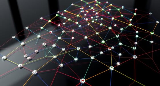

Point clouds are collections of millions of points in 3D space that represent the surfaces of objects and environments. Computers interpret these points by analyzing their coordinates and relationships to understand shapes, contours, and textures. They process raw data, remove noise, and convert it into structured models like meshes or surfaces. This allows for detailed visualization, measurement, and analysis. Keep exploring to discover more about how these data sets bring digital worlds to life.
Key Takeaways
- Computers interpret point clouds as collections of 3D coordinates representing object surfaces and spatial relationships.
- Data processing filters noise and organizes points into structured formats like meshes or surfaces.
- Algorithms analyze point distribution to identify shapes, contours, and surface features.
- Visualization software converts raw points into comprehensible 3D models for inspection and analysis.
- Accurate shape understanding depends on data quality, processing techniques, and the interpretation of spatial patterns.
Point clouds are a powerful way to represent three-dimensional data by capturing the precise shape and location of objects in space. When you work with point clouds, you’re fundamentally gathering millions of data points that detail the surface of an object or environment. These points are collected through laser scanners, photogrammetry, or other sensing technologies, creating a dense map of the area. This data is vital for 3D visualization because it allows you to see and analyze complex structures from multiple angles, providing an accurate digital replica of the real world. As you process this data, you transform raw point clouds into useful models, making it easier to interpret and manipulate the information for various applications. Understanding the importance of data accuracy is essential for ensuring the reliability of your 3D models.
Point clouds capture detailed 3D data, creating accurate digital replicas of objects and environments for analysis and visualization.
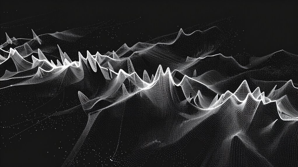
Data processing is an essential step in handling point clouds. The raw data often contains noise, redundant points, or gaps, which need cleaning and refinement before meaningful analysis. You might use algorithms to filter out outliers or reduce the number of points, balancing detail with computational efficiency. Once cleaned, the data can be converted into more structured forms, such as meshes or surfaces, enabling you to better understand the shape and features of the scanned object. These processing steps are vital for converting vast amounts of unorganized points into a coherent, usable 3D model. Additionally, data quality plays a crucial role in the accuracy of the final models, emphasizing the importance of precise data collection and processing techniques. A good understanding of data collection methods can significantly improve the fidelity of your models. Proper data collection strategies help enhance the overall model accuracy, ensuring your digital representations are reliable. Recognizing the limitations of sensors involved in data collection can further refine your results.
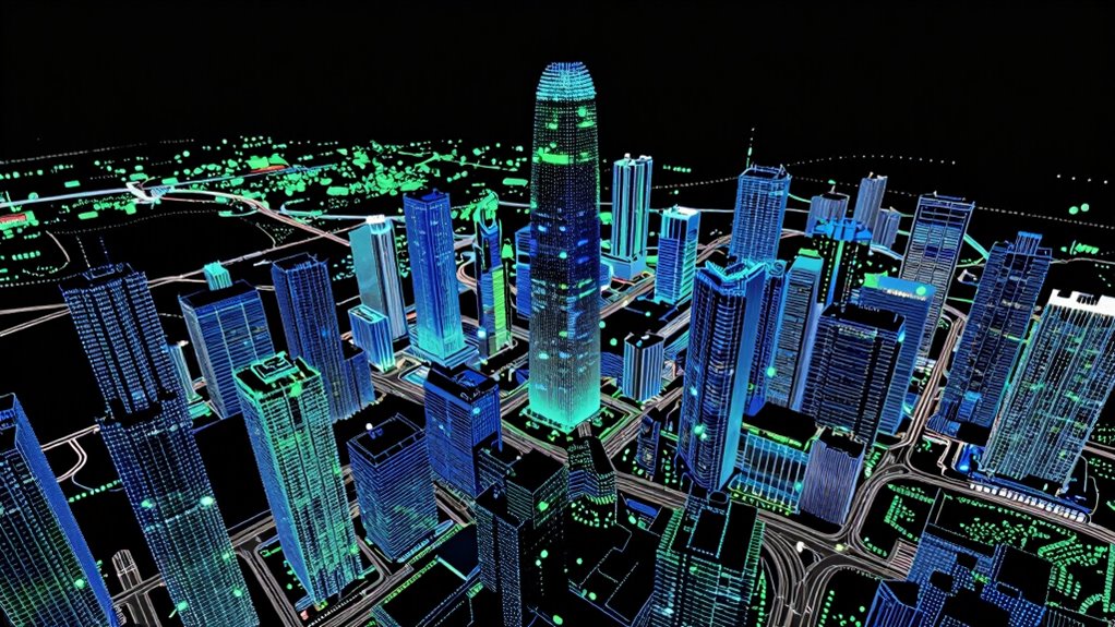
Your ability to perform effective 3D visualization depends heavily on how well you process the data. With the right tools, you can generate detailed visual representations that highlight surface textures, contours, and spatial relationships. Whether you’re designing a building, inspecting infrastructure, or creating virtual environments, visualization helps you communicate complex spatial information clearly. It also allows for precise measurements and analysis, which are indispensable in fields like architecture, engineering, or archaeology.
Throughout this process, understanding how computers interpret point clouds is key. The data is fundamentally a collection of coordinates in space, and your software translates these points into visual and structural insights. By mastering data processing techniques, you guarantee that your 3D visualizations are accurate and reliable. This understanding empowers you to leverage point clouds in innovative ways, from creating detailed digital twins to assisting in complex planning or forensic investigations. Ultimately, the seamless integration of 3D visualization and data processing turns simple points into powerful insights about the shape and structure of the world around you.
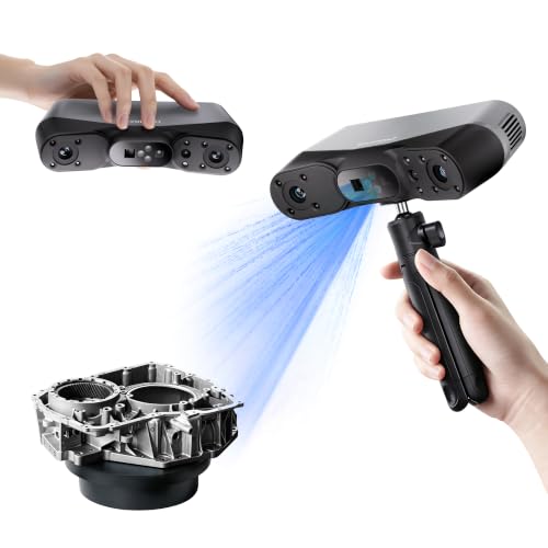
Revopoint POP 4 3D Scanner, AI Segmentation, for 3D Printing, Premium
- High Precision: 0.03 mm accuracy for detailed scans
- Fast Scanning Speed: Up to 105 fps for rapid capture
- Multiple Scanning Modes: 5 versatile scanning options
As an affiliate, we earn on qualifying purchases.
As an affiliate, we earn on qualifying purchases.
Frequently Asked Questions
How Are Point Clouds Generated From Real-World Objects?
You generate point clouds from real-world objects by using sensors like LiDAR or 3D scanners, which capture precise measurements. Sensor accuracy and data resolution are vital because they determine how detailed and accurate your point cloud will be. As the sensor scans the object, it collects millions of points reflecting its shape. Higher data resolution means more points, resulting in a more detailed and accurate digital representation of the object.
What Are Common Challenges in Processing Large Point Cloud Datasets?
You face challenges like managing data size, reducing noise, and ensuring accuracy. Data compression helps you handle large datasets efficiently, but risks losing detail. Noise reduction allows you to clean the data, yet it can sometimes remove important features. Balancing these tasks requires careful processing, as you aim to maintain precision while minimizing data complexity. Ultimately, handling big point clouds demands both technical skill and thoughtful strategies to keep datasets manageable and reliable.
How Do Point Clouds Differ From 3D Meshes?
You’ll find that point clouds differ from 3D meshes mainly in data structure and application. Point clouds consist of individual data points capturing shape and surface details, while meshes connect those points into polygons for a more structured surface. When converting point clouds to meshes, maintaining data accuracy is essential, as it influences the quality of mesh conversion. Meshes often enable easier visualization, but point clouds provide a more precise, raw representation of shape.
What Industries Heavily Rely on Point Cloud Technology?
You’ll find industries like construction, automotive, and agriculture heavily rely on point cloud technology. LiDAR applications are vital for creating detailed 3D maps and models, especially in industrial scanning. These tools help professionals accurately survey sites, design structures, and monitor progress. By capturing precise spatial data, you can improve safety, efficiency, and decision-making across various sectors, making point clouds indispensable for modern industrial and environmental projects.
Can Point Clouds Be Used for Real-Time 3D Modeling?
Imagine capturing a scene so vividly that it feels like you’re there; yes, point clouds can be used for real-time 3D modeling. With advances in processing speed and real-time updates, you can now generate and modify models on the fly. This technology is perfect for applications like construction monitoring, autonomous navigation, or virtual reality, where instant data processing creates seamless, dynamic 3D representations.

WayPonDEV Unitree L2 4D 3D Lidar Sensor Scanner – 360°×90° 30 Meters(98.42ft) Wide Angle Scanning – 128K Points/s Frequency – ROS SLAM Range Finder Module Kit for Robots AGV Obstacle Avoidance
- Enhanced Performance: Built-in IMU with 250Hz support
- Long Range Scanning: Detects up to 30 meters
- High Sampling Rate: 128K points/sec for detailed scans
As an affiliate, we earn on qualifying purchases.
As an affiliate, we earn on qualifying purchases.
Conclusion
Now that you’ve seen how point clouds transform scattered data into a vivid 3D picture, imagine what you’ll discover next. Like a treasure map revealing hidden worlds, these data points reveal endless possibilities in design, robotics, and beyond. So, next time you see a digital model, remember—it’s not just pixels, but a symphony of points orchestrating a stunning reality. Embrace this technology, and step into the future of understanding shape itself.

Automotive 4D Imaging Radar Engineering: FMCW Signal Processing, Point Cloud Perception, and Sensor Fusion for ADAS: A Complete Engineering Guide from Chirp Design to Object Track
As an affiliate, we earn on qualifying purchases.
As an affiliate, we earn on qualifying purchases.

Revopoint MetroY Ultra 3D Scanner, Up to 90 FPS, for 3D Printing, Standard
- High Precision: 0.01mm single-frame accuracy
- Advanced Laser Technology: Blue laser for detailed scans
- Multiple Scanning Modes: Five versatile scanning options
As an affiliate, we earn on qualifying purchases.
As an affiliate, we earn on qualifying purchases.