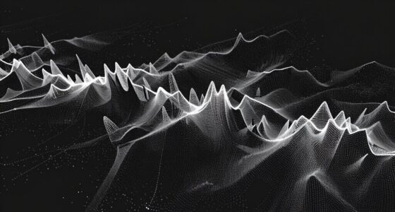

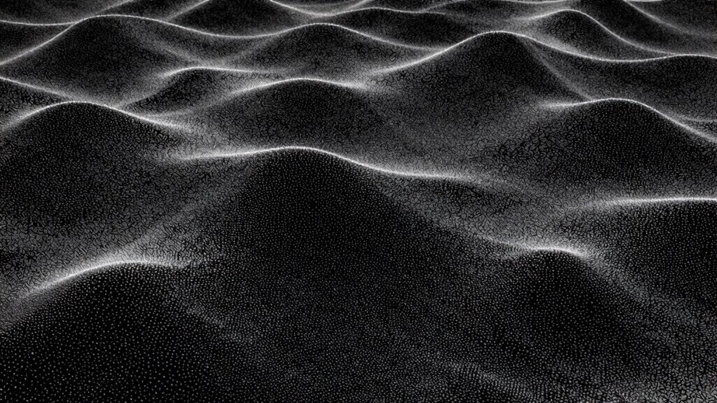
Point clouds are collections of millions of spatial data points captured by sensors like LiDAR, representing an object’s shape and surface. To transform these points into surfaces, you analyze their spatial relationships, detect features like edges and curvature, and connect points through techniques like triangulation and mesh creation. Overcoming challenges such as noise and data sparsity requires robust algorithms. Continue exploring how surface formation unlocks the full potential of point cloud data.
Key Takeaways
- Surface formation involves connecting spatially related points through triangulation, meshing, and smoothing techniques to create continuous 3D shapes.
- Geometric feature extraction, such as curvature and edge detection, guides accurate surface reconstruction from raw point cloud data.
- Noise filtering and data preprocessing are essential for improving surface quality and handling sensor inaccuracies.
- Techniques like Delaunay triangulation, Poisson reconstruction, and RANSAC help fit models to point cloud data efficiently.
- Understanding local and global geometry ensures the generated surfaces accurately reflect the object’s shape and surface topology.

SHARE SLAM S20 3D LiDAR Scanner,Handheld Professional Surveying Design Architecture Scanning Measurement Spatial Camera Point Cloud 3DGS,Indoor and Outdoor Spaces, 1-Inch Sensor Accuracy 1cm 70m Range
High-Precision & Long-Range Scanning: Dual 1-inch large area CMOS sensors deliver 16MP resolution per lens with 2.4μm pixel…
As an affiliate, we earn on qualifying purchases.
As an affiliate, we earn on qualifying purchases.
What Are Point Clouds and Why Are They Important?
Have you ever wondered how 3D models are created from real-world objects? Point clouds are essential for this process. They consist of millions of data points captured by sensors like LiDAR or 3D scanners, representing an object’s shape and surface. To guarantee accuracy, you need proper sensor calibration, which aligns data with real-world measurements. Data filtering also plays a crucial role by removing noise and irrelevant points, making the point cloud clearer and more reliable. These steps help transform raw sensor data into precise, detailed 3D representations. High-resolution imaging is important in capturing detailed point cloud data, especially in complex environments. Additionally, sensor calibration ensures the spatial accuracy of the data, which is vital for reliable modeling. Point clouds are vital in industries like architecture, manufacturing, and autonomous vehicles, where accurate spatial information is key. Without proper calibration and filtering, though, the data can be distorted, undermining the entire modeling process.

3D Data Science with Python: Building Accurate Digital Environments with 3D Point Cloud Workflows
As an affiliate, we earn on qualifying purchases.
As an affiliate, we earn on qualifying purchases.
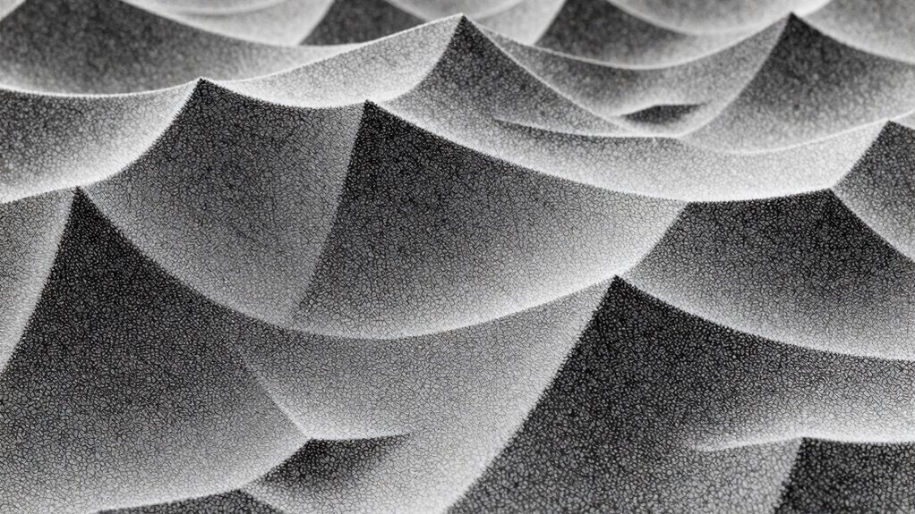
How Do Point Sets Form Surfaces? (Basic Geometry Explained)
Point sets form surfaces through the process of connecting individual points based on their spatial relationships. Using geometric principles, you analyze how points relate to each other in space, determining which are neighbors and how they align. This process helps define the surface topology, revealing the overall shape and structure of the object. By examining local arrangements, you can identify smooth regions, edges, and boundaries. The key is understanding how points cluster and form continuous or discrete surfaces. These relationships guide the creation of mesh structures or surface models. Fundamentally, the way points connect reflects the underlying geometry, enabling you to reconstruct surfaces that accurately represent complex shapes. Recognizing spatial relationships is essential for converting raw point data into meaningful, navigable 3D surfaces. Additionally, understanding the geometric configuration of points allows for more precise surface modeling and analysis. Moreover, analyzing these configurations helps in identifying surface features, which are crucial for detailed surface reconstruction and interpretation.
3D Data Science with Python: Building Accurate Digital Environments with 3D Point Cloud Workflows
As an affiliate, we earn on qualifying purchases.
As an affiliate, we earn on qualifying purchases.
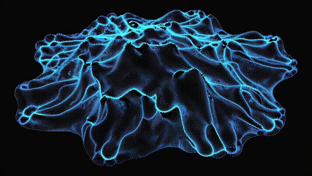
How Do We Convert Raw Point Data Into 3D Meshes?

Transforming raw point data into 3D meshes involves connecting individual points to form a continuous surface, effectively turning scattered data into a coherent shape. To do this, you start by detecting edges that define the shape’s boundaries. Then, noise filtering cleans up the data, removing outliers that could distort the mesh. Once the data is clean, algorithms analyze the proximity of points to establish connections, creating a network of triangles or polygons. These steps ensure a smooth, accurate surface reconstruction. Key techniques include:
Connecting points and filtering noise creates accurate 3D mesh surfaces from raw data.
- Edge detection to identify boundaries
- Noise filtering to improve data quality
- Point connectivity analysis
- Triangulation methods
- Surface smoothing adjustments
This process transforms raw data into a usable 3D model, ready for visualization or further processing.

Creality Official 3.0 mm 3D Scanning Marker for 3D Scanner, 3D Tracking Dot Reference Point Markers, Diffuse Reflection Markers (5 Sheet 420 Dots)
These 3D Scanning Markers are easy to stick on and peel back off when your projects done.
As an affiliate, we earn on qualifying purchases.
As an affiliate, we earn on qualifying purchases.
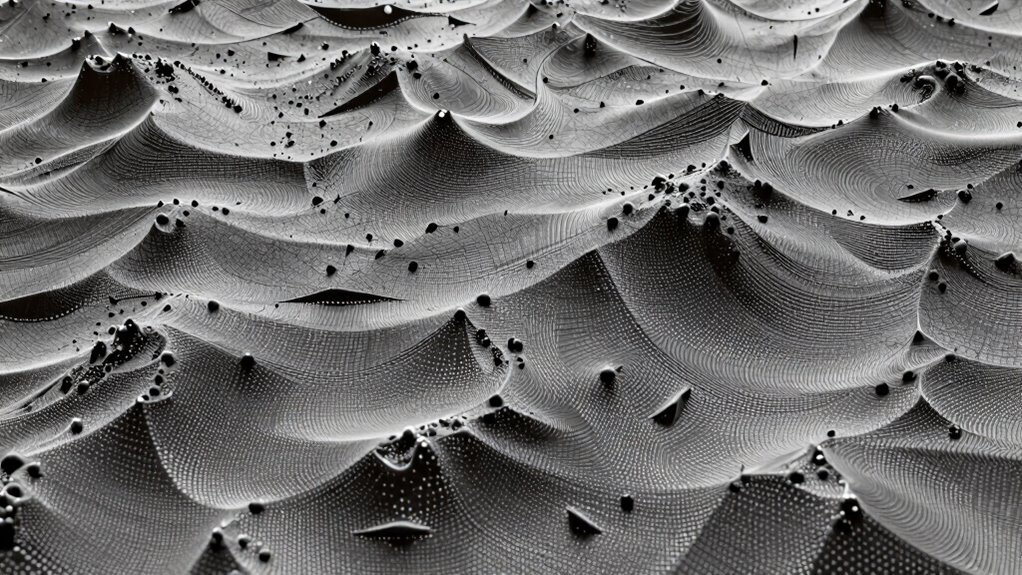
What Are the Main Surface Reconstruction Techniques for Point Clouds?
Surface reconstruction techniques are essential for converting raw point cloud data into detailed 3D models. One common method involves creating meshes that connect points, which can then be simplified through mesh simplification to reduce complexity while preserving shape details. This process helps manage large datasets and speeds up rendering. Texture mapping further enhances these models by projecting images onto surfaces, adding realistic color and detail. Techniques like Delaunay triangulation, Poisson surface reconstruction, and ball-pivoting are popular for generating accurate surfaces from point clouds. Each method balances precision and efficiency, depending on your project’s needs. Understanding the underlying algorithms can help optimize your surface reconstruction process. By combining these techniques, you can produce clean, detailed models ready for visualization, analysis, or further editing. Additionally, detect passive voice can improve clarity and engagement in the final presentation of your models. Exploring surface quality assessment methods can also ensure the reconstructed surfaces meet your desired standards, while considering algorithm efficiency can further streamline your workflow.
How Do Local and Global Geometric Features Help Analyze Point Clouds?
Understanding local geometry insights helps you identify fine details and surface variations in a point cloud. Global shape recognition allows you to grasp the overall structure and form of the object. Using feature extraction techniques, you can efficiently analyze these geometric cues to interpret complex point cloud data. Additionally, leveraging peer-reviewed studies ensures that the analysis remains accurate and grounded in current scientific understanding.
Local Geometry Insights
Have you ever wondered how analyzing local geometric features can enhance your understanding of point clouds? By focusing on small regions, you can identify edges, corners, and surface variations more accurately. Techniques like edge detection help you highlight sharp shifts, while curvature estimation reveals how surfaces bend locally. These insights enable you to distinguish between flat areas and intricate details, improving surface reconstruction and segmentation. Understanding local geometry also aids in noise reduction and feature extraction.
- Detect edges and corners with precision
- Estimate curvature to understand surface bending
- Differentiate between smooth and rough regions
- Improve segmentation accuracy
- Enhance surface reconstruction quality
Global Shape Recognition
While analyzing local geometric features provides detailed insights into specific regions of a point cloud, recognizing the overall shape requires combining these details with broader contextual information. You need accurate sensor calibration to guarantee reliable data collection, as miscalibrated sensors can distort the global shape. Data segmentation helps organize the point cloud into meaningful regions, making it easier to identify overarching structures. By grouping points based on geometric continuity and spatial relationships, you can distinguish different parts of an object or scene. This process allows you to step back from minute details and grasp the overall form. Combining local features with segmentation results enables a holistic understanding of the point cloud’s global shape, essential for applications like 3D modeling and scene reconstruction. Additionally, understanding the time zones involved in data collection can improve synchronization across multiple sensors and enhance the accuracy of the reconstructed surfaces. Moreover, employing sensor calibration techniques ensures the fidelity of the spatial data, which is crucial for accurate shape recognition.
Feature Extraction Techniques
Feature extraction techniques are fundamental in analyzing point clouds because they transform raw data into meaningful descriptors that capture both local and global geometric properties. These techniques enable you to identify key features like edges, surfaces, and curvatures, which are vital for understanding complex structures. Edge detection helps highlight boundaries and sharp features, while noise filtering removes irrelevant data points that can distort analysis. By extracting local features, you can better understand fine details, and global features provide insight into overall shape and form. Effective feature extraction enhances surface reconstruction, segmentation, and classification tasks.
- Detect edges and boundaries for detailed shape analysis
- Filter noise to improve data quality
- Capture local curvature and surface variations
- Extract global shape descriptors for overall structure
- Enable accurate segmentation and classification
How Do Algorithms Detect and Fit Surfaces in Point Clouds?

How do algorithms identify and model surfaces within complex point clouds? They start by filtering out noise, which can distort surface detection, ensuring cleaner data. Noise filtering smooths irregularities, making surface features more apparent. Next, they use methods like mesh simplification to reduce data complexity while preserving essential details. This process streamlines the point cloud, making surface fitting more efficient. Algorithms then analyze the remaining points, looking for patterns that indicate underlying surfaces. Techniques such as RANSAC or region growing help detect planar or curved surfaces by fitting mathematical models to the data. These models are refined iteratively, improving accuracy. Additionally, the geometry of surfaces plays a crucial role in guiding the fitting process, ensuring models accurately reflect real-world structures. The surface curvature provides important cues for differentiating various types of surfaces in complex geometries. Furthermore, understanding the properties of surfaces helps algorithms adapt to different geometrical features, resulting in more precise modeling. Recognizing the influence of material properties can also assist in distinguishing between different surface types, especially in textured or layered materials. Ultimately, the algorithms produce a surface representation that balances detail with computational efficiency, enabling accurate modeling of complex geometries in the point cloud.
What Are Common Challenges in Surface Extraction From Point Clouds? (And How to Overcome Them)

Extracting surfaces from point clouds presents several significant challenges that can hinder accurate modeling. Noise filtering is essential to remove irregularities that distort the surface, but over-filtering risks losing important details. Data sparsity makes it difficult to generate smooth, continuous surfaces, especially in areas with few points. Additionally, uneven point distribution can cause inaccuracies in surface fitting. Outliers may skew results, requiring careful preprocessing. Managing these issues often involves balancing filtering techniques, increasing data density when possible, and choosing robust algorithms. Furthermore, understanding the sensor specifications and data collection methods can help mitigate some of these issues from the outset.
What Are the Future Trends Improving Surface Representation in Point Clouds?
Advancements in machine learning and artificial intelligence are poised to revolutionize surface representation in point clouds. You’ll see smarter algorithms that can automatically interpret complex data, reducing manual preprocessing. These models will enhance the accuracy of surface reconstructions by learning from vast datasets, minimizing noise and gaps. These improvements will also extend to data visualization, making it easier to interpret 3D structures with clearer, more detailed surfaces. Future trends include real-time surface reconstruction, enabling dynamic applications like autonomous navigation and AR. Additionally, hybrid approaches combining traditional geometric methods with AI will offer more robust and efficient solutions. As these technologies evolve, you’ll gain more precise, scalable, and user-friendly tools to transform raw point cloud data into meaningful, high-quality surface representations. Understanding surface reconstruction techniques is essential for leveraging these future innovations effectively. Moreover, ongoing research in data processing algorithms is continuously optimizing how raw data is transformed into accurate surface models. Emerging techniques such as deep learning-based surface inference are also expected to significantly enhance the fidelity and speed of surface reconstructions in the near future.
Frequently Asked Questions
How Do Different Scanning Technologies Affect Point Cloud Quality?
Different scanning technologies considerably impact your point cloud quality through sensor accuracy and data density. High-precision sensors capture more accurate points, reducing errors, while higher data density ensures detailed surface representation. For example, laser scanners offer superior accuracy and dense data, ideal for detailed surfaces, whereas photogrammetry may be less precise but faster. Your choice depends on the required detail and accuracy, influencing the overall quality of your point cloud.
Can Point Clouds Accurately Represent Complex, Organic Surfaces?
Sure, point clouds can mimic complex, organic surfaces—if you enjoy pixelated Picasso. While they capture organic detail and surface complexity better than a rough sketch, they still struggle with smooth, flowing forms. The more intricate the surface, the more points you need. So, if you’re aiming for high fidelity in organic shapes, expect some jagged edges and missing nuances—like a sculpture carved by a blindfolded artist.
How Does Noise Impact the Surface Reconstruction Process?
Noise from sensor distortion can considerably affect your surface reconstruction, creating inaccuracies and rough surfaces. It can make your point cloud data less reliable, complicating the process. To combat this, you should apply data smoothing techniques to minimize the impact of noise. This helps to produce cleaner, more accurate surfaces, ensuring your reconstructed models better reflect the real-world objects, even when initial data is affected by sensor imperfections.
What Role Does Color Information Play in Surface Modeling?
Imagine painting a landscape; color breathes life into it. In surface modeling, color information acts as a guide for color enhancement and texture mapping, making surfaces more realistic and detailed. It helps differentiate features, adds depth, and improves visual clarity. Your model becomes more than just geometry—it’s a vibrant, textured scene. By integrating color, you create a richer, more immersive experience, transforming raw point clouds into mesmerizing, lifelike surfaces.
Are There Real-Time Applications for Surface Extraction From Point Clouds?
Yes, there are real-time applications for surface extraction from point clouds. You can use lidar mapping for rapid 3D environment reconstruction, essential in autonomous vehicles and robotics. Augmented reality also benefits, allowing you to overlay virtual surfaces onto real-world scenes instantly. These applications rely on efficient algorithms that process point clouds in real time, enabling seamless integration of digital and physical environments for navigation, analysis, and immersive experiences.
Conclusion
By understanding how point clouds form surfaces, you can better visualize complex 3D data. Don’t worry about gaps or noise—advanced algorithms and techniques help you reconstruct accurate surfaces, like connecting dots to reveal a detailed mesh. Think of it as transforming scattered points into a clear, tangible shape. With ongoing innovations, you’ll find it easier than ever to turn raw data into meaningful 3D models, unblocking new possibilities in design, analysis, and visualization.