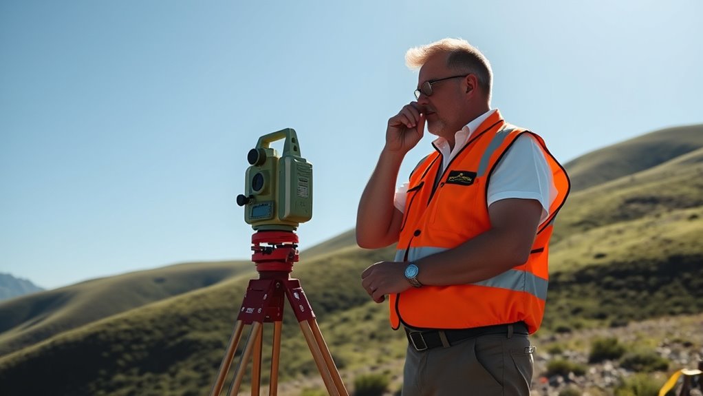

A land surveyor uses geometry combined with advanced tools like GPS to accurately measure and map land boundaries. They determine property lines by applying mathematical principles, ensuring measurements are precise. This process helps prevent disputes and clarifies ownership. With modern technology, boundary marking becomes faster and more reliable. If you’re curious about how geometry and cutting-edge tools work together to map the earth, you’ll find plenty more details below.
Key Takeaways
- Land surveyors use geometric principles to determine precise land boundaries and measurements.
- Geometry helps in calculating distances, angles, and coordinates during land surveying processes.
- Triangulation and trilateration are geometric methods for mapping large areas accurately.
- Surveyors apply geometric calculations to interpret legal descriptions and resolve boundary ambiguities.
- Modern GPS technology integrates geometric data for precise, efficient land measurement and boundary delineation.

A land surveyor plays an essential role in mapping and measuring land boundaries to guarantee accurate property boundaries and land development. You rely on precise measurements to avoid conflicts and ensure everyone knows exactly where their property begins and ends. Modern tools like GPS technology have revolutionized how you do this work, allowing for faster and more accurate data collection. GPS helps you pinpoint boundary lines with incredible precision, even over large or difficult terrains. By integrating GPS data into your surveys, you can resolve boundary disputes more effectively. When property owners disagree over where their land ends, your accurate measurements become the key to settling conflicts fairly. You can quickly identify the true boundaries, reducing legal disputes and easing tensions between neighbors.
Using GPS technology, you can gather data in real-time, making the surveying process more efficient. This technology provides detailed coordinate points that form the backbone of your boundary delineations. These points are essential for creating accurate boundary maps, especially when legal descriptions are vague or outdated. You also use GPS to cross-verify existing boundary markers, such as fences or survey pins, ensuring their placement aligns with official records. When discrepancies arise, your expertise helps clarify the situation, preventing boundary disputes from escalating. Your ability to precisely locate property lines with GPS can save landowners from costly legal battles and lengthy litigation.
Boundary disputes often occur because of unclear or inaccurate land descriptions, outdated maps, or natural changes to the landscape. As a surveyor, you play an integral role in preventing these conflicts by providing clear, reliable data. You gather precise measurements, interpret legal descriptions, and create detailed maps that serve as official records. Your work often involves revisiting previous surveys or resolving ambiguity in property descriptions, all while using advanced tools to ensure accuracy. When disputes do happen, your detailed reports and surveyed data serve as essential evidence in court or negotiations, helping all parties reach fair resolutions. Additionally, automation in technology continues to improve the speed and reliability of your work, making boundary determinations even more precise.
In today’s landscape of complex property laws and increasing land development, your role as a surveyor is more important than ever. GPS technology enhances your ability to produce reliable, detailed surveys that stand up to scrutiny. By doing so, you help landowners, developers, and legal professionals avoid disputes and move forward with confidence. Your expertise ensures that land boundaries are defined with the highest precision, making sure that property rights are respected and protected for years to come.

ZL180 Handheld GPS for Surveying, High Precision Rugged Land Surveying Equipment for Ranches, Garden, Farmland and Parking Area Distance Measuring
- High Precision GPS: Global GPS + GLONASS for accurate surveying
- Fast Positioning: Reliable signal with quick location updates
- Large LCD Screen: 2.4-inch backlit display for easy reading
As an affiliate, we earn on qualifying purchases.
As an affiliate, we earn on qualifying purchases.
Frequently Asked Questions
What Tools Do Land Surveyors Use Besides Theodolites and GPS?
Besides theodolites and GPS, you also use survey equipment like total stations, drones, and laser scanners. Total stations combine electronic distance measurement with angles for precise data collection, while drones help you capture aerial imagery and topography. Laser scanners quickly produce detailed 3D models of landscapes. You analyze all this data carefully to guarantee accurate measurements, mapping, and boundary determination, making your surveys reliable and thorough.
How Does Terrain Affect Survey Accuracy?
Terrain tampering can truly twist your survey’s accuracy. The variability of terrain, from rugged ridges to rolling plains, introduces unexpected errors. Elevation influence can skew measurements, making elevations seem higher or lower than they are. You must meticulously monitor these influences, adjusting your tools and techniques accordingly. By understanding terrain variability and elevation effects, you guarantee precise, reliable survey results despite unpredictable land features.
What Are Common Challenges Faced During Land Surveying?
You often face challenges like inaccurate survey data integration and coordinating with urban planning collaboration. Difficult terrain, weather conditions, and dense structures can disrupt data collection, making it harder to produce precise results. Additionally, ensuring all stakeholders share updated information can be tricky. Overcoming these obstacles requires careful planning, effective communication, and advanced technology to maintain accuracy and streamline the survey process amidst these common challenges.
How Do Surveyors Ensure Legal Boundary Accuracy?
Your job guarantees boundary accuracy by meticulously analyzing boundary disputes and cross-referencing historical mapping records. You double-check survey markers, use precise GPS technology, and consult legal documents to prevent errors. This thorough approach prevents costly mistakes and keeps boundaries clear and undisputed. You’re like the guardian of property lines, making sure every boundary is accurate and legally sound, avoiding future conflicts and safeguarding property rights.
What Certifications Are Required to Become a Licensed Surveyor?
To become a licensed surveyor, you need to meet the certification requirements for survey licensing. You must typically earn a degree in geomatics, surveying, or a related field, and gain practical experience through internships or work hours. Afterward, you’ll need to pass the Fundamentals of Surveying exam and a state-specific licensing exam. These steps guarantee you meet the professional standards and are qualified to perform surveying duties legally.

BOSCH GLM100-23 100 Ft Blaze Laser Distance Measure, Includes 2 AA Batteries, Distance Measuring Laser
- Long Range Measurement: Measures up to 100 feet accurately
- Precise Readings: Within 1/16 inch accuracy
- Multi-Unit Display: Displays in meters, feet, inches
As an affiliate, we earn on qualifying purchases.
As an affiliate, we earn on qualifying purchases.
Conclusion
Just as Columbus charted unknown waters, you navigate the complex landscape of land with precision and purpose. Your measurements shape the world, turning abstract ideas into tangible reality. Remember, every line you draw echoes the silent wisdom of ancient explorers who believed in discovery’s power. Keep honing your skills, for in your hands lies the key to revealing Earth’s secrets—guiding others to see the bigger picture beyond what meets the eye.

Zozen 50Pack Fluorescent Orange Marking Flags, Writable/15x4x5 Inch, Yard Flags for Lawn & Irrigation & Landscape & Sprinkler & Survey & Dog Training.
- Durable PVC Material: Resistant to fading and tearing
- Strong Steel Wire Poles: Easily penetrate soil without deforming
- Writable Surface: Supports marking for better identification
As an affiliate, we earn on qualifying purchases.
As an affiliate, we earn on qualifying purchases.
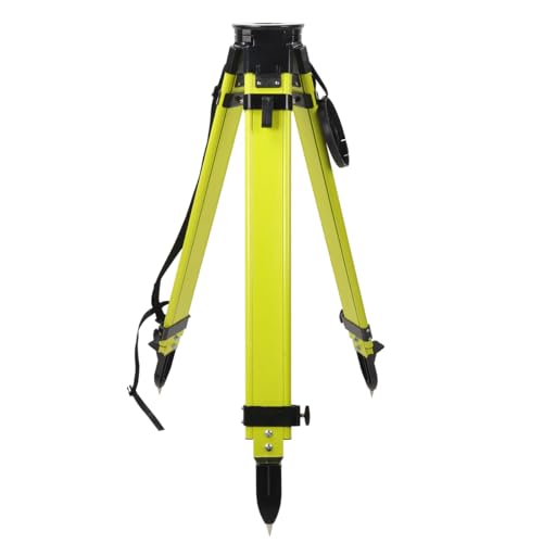
Fiberglass Surveying Tripod, Heavy Duty Yellow Fiberglass and Wood Tripod with Dual Clamp and Copper Center Screw for Robotic Total Stations and Theodolite (Round Head-B)
- Large Round Head Diameter: 162mm precision machined head
- Heavy Duty Construction: Fiberglass and wood materials for durability
- Dual Lock Stability: Dual clamp design for extra stability
As an affiliate, we earn on qualifying purchases.
As an affiliate, we earn on qualifying purchases.