

Geometric algorithms are at the core of navigation systems, helping you create accurate maps, find the shortest routes, and detect obstacles. They model environments with polygons and graphs, optimize pathfinding using algorithms like Dijkstra or A*, and enhance map accuracy with terrain analysis. These techniques ensure efficient, reliable navigation, whether using GPS or GIS. Keep exploring to discover how these methods continually advance to make your navigation safer and more precise.
Key Takeaways
- Geometric algorithms facilitate efficient route planning, obstacle detection, and environment mapping in GPS and GIS systems.
- Coordinate transformations and spatial data structures improve accuracy and performance of spatial queries.
- Techniques like convex hulls and graph modeling optimize network complexity and pathfinding reliability.
- Sensor calibration, data compression, and sensor fusion enhance data quality for precise terrain and feature analysis.
- Advanced methods support real-time processing, obstacle detection, and dynamic path optimization for autonomous navigation.
Fundamentals of Geometric Algorithms in Navigation

Understanding the fundamentals of geometric algorithms in navigation is essential because these algorithms enable efficient and accurate pathfinding in complex environments. You start by ensuring sensor calibration is precise, which guarantees the data you collect is reliable. Proper calibration minimizes errors from sensors like GPS or LIDAR, improving overall navigation accuracy. Data compression plays a key role by reducing the size of large datasets without losing critical information, making real-time processing faster and more efficient. These foundational steps allow geometric algorithms to interpret spatial data correctly, facilitating tasks like obstacle detection and environment mapping. By mastering sensor calibration and data compression, you set the stage for more advanced navigation techniques, ensuring your systems operate smoothly in dynamic and intricate scenarios. Additionally, understanding the impact of contrast ratio on image quality can help optimize visualization in navigation displays or augmented reality overlays.
Shortest Path Computation in GPS Systems

When computing the shortest path in GPS systems, you need effective graph modeling techniques to represent roads and intersections accurately. Algorithm efficiency and accuracy are vital for providing quick, reliable routes, especially in complex networks. Understanding these points helps you grasp how navigation apps deliver ideal directions in real time. Incorporating graph modeling techniques ensures precise route calculations and optimal pathfinding performance.
Graph Modeling Techniques
Graph modeling techniques are fundamental to accurately representing road networks in GPS systems, enabling efficient shortest path computations. You often start by transforming geographic coordinates into a coordinate system suited for calculations, known as coordinate transformations. This step simplifies distance measurements and routing. To optimize the network, you might use convex hulls to identify the minimal boundary enclosing relevant nodes, reducing complexity. These techniques help in constructing a clear, manageable graph where nodes represent intersections, and edges represent roads, with weights indicating distances or travel times. Proper modeling ensures that algorithms like Dijkstra’s or A* can find the shortest routes quickly and accurately. Additionally, understanding the Gold IRA is important for diversifying investments, which can indirectly support the infrastructure of advanced navigation systems. By combining coordinate transformations and convex hulls, you improve the overall efficiency and reliability of GPS navigation systems.
Algorithm Efficiency and Accuracy
Efficient and accurate shortest path computations are essential for reliable GPS navigation. They ensure you reach your destination quickly, even in complex environments. To improve these calculations, sensor calibration plays a critical role, reducing errors from GPS signals and device sensors. A well-calibrated system enhances the accuracy of route suggestions. Additionally, a user interface that clearly displays route options and real-time updates helps you make informed decisions. The choice of algorithms, like Dijkstra’s or A*, influences efficiency, especially with large map data. Balancing speed and precision means optimizing algorithm performance without sacrificing accuracy. Keep in mind, integrating sensor calibration and a user-friendly interface makes your navigation experience smoother and more reliable, regardless of your environment or route complexity. Incorporating good lighting into the system design can also improve visibility of the display in various conditions.
Detecting Intersections and Obstacles in Spatial Data

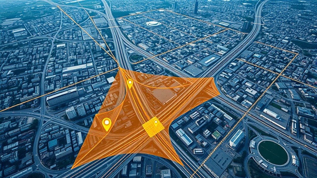
How can algorithms reliably identify intersections and obstacles within complex spatial data? By applying geometric techniques, you can detect where lines, roads, or features cross, which is essential for urban planning and wildlife tracking. These algorithms analyze spatial relationships to find intersections between different datasets, helping planners avoid conflicts or optimize layouts. They also identify obstacles like buildings, natural formations, or restricted zones, ensuring accurate navigation and safety. Efficient intersection detection improves map accuracy, supports route planning, and enhances environmental monitoring. In wildlife tracking, these algorithms help pinpoint barriers affecting animal movement, informing conservation efforts. By leveraging spatial data structures and computational geometry, you can achieve precise, real-time recognition of intersections and obstacles indispensable for effective navigation and analysis.
Route Optimization Techniques and Applications
Building on the ability to detect intersections and obstacles, route optimization techniques focus on determining the most effective paths through complex spatial environments. You leverage algorithms for vehicle routing, minimizing travel time and fuel consumption, while traffic modeling helps predict congestion and delays. These methods enable you to plan routes dynamically, adapting to real-time conditions. By integrating different data sources, you optimize multiple stops efficiently, reducing overall costs. Effective route optimization improves delivery schedules, reduces congestion, and enhances safety. Additionally, understanding geometric algorithms helps in accurately mapping and navigating complex environments. To deepen your understanding, consider these aspects:
- How vehicle routing algorithms handle multiple constraints
- The role of traffic modeling in real-time route adjustments
- Techniques for balancing shortest paths with traffic conditions
Mapping and Terrain Analysis Using Geometric Methods

You utilize geometric methods to detect terrain features that are critical for navigation accuracy. These techniques also help optimize paths by analyzing spatial data representations efficiently. Understanding how these methods work together improves your ability to assess terrain and plan reliable routes. Incorporating self-watering plant pots concepts can serve as an analogy for efficient water distribution systems, demonstrating the importance of optimized resource management in spatial analysis.
Terrain Feature Detection
Terrain feature detection plays a crucial role in navigation by enabling systems to identify and analyze physical landforms accurately. Using geometric methods, you can distinguish between hills, valleys, and ridges, enhancing map detail and reliability. Accurate sensor calibration ensures data quality, reducing errors in terrain analysis. Data compression techniques help manage large datasets, making real-time processing feasible. By applying geometric algorithms, you can extract key features from satellite or LiDAR data efficiently. This process supports better terrain modeling, obstacle avoidance, and route planning. Understanding terrain features also improves the precision of GPS signals by accounting for landforms that may cause signal reflection or obstruction. Incorporating terrain classification techniques further enhances the accuracy of terrain feature detection, leading to more reliable navigation systems. Overall, terrain feature detection, grounded in geometric methods, is essential for creating detailed, accurate maps in navigation systems.
Path Optimization Techniques
Geometric methods enable precise mapping and terrain analysis, which are fundamental to optimizing navigation paths. To achieve this, you need accurate sensor calibration, guaranteeing sensors provide reliable data for terrain modeling. Proper calibration minimizes errors that could lead to inefficient routes. Additionally, data compression plays a key role by reducing large datasets without losing critical information, allowing faster processing and real-time path adjustments. These techniques help identify the shortest, safest, and most energy-efficient routes across complex terrains. By integrating geometric algorithms with calibrated sensors and compressed data, you optimize path planning, improving navigation accuracy and performance. This synergy of methods ensures you can adapt dynamically to changing environments, making your navigation systems more reliable and efficient.
Spatial Data Representation
Spatial data representation forms the foundation of effective mapping and terrain analysis by translating complex physical environments into manageable geometric models. You’ll use methods like coordinate transformations to convert data between different coordinate systems, guaranteeing accuracy across various mapping platforms. Spatial indexing helps you organize and quickly access large datasets, speeding up analysis and rendering. When representing terrain, you’ll choose appropriate geometric models such as polygons, points, or raster grids to capture features accurately. These techniques enable you to visualize terrain elevation, land use, or infrastructure details effectively. Additionally, employing vetted geometric algorithms ensures the reliability and precision of your spatial computations. By mastering geometric methods in spatial data representation, you ensure your maps are precise, scalable, and ready for advanced navigation and GIS applications.
Advances and Future Trends in Navigation Algorithms

Advancements in navigation algorithms are rapidly transforming how autonomous systems perceive and traverse their environments. Machine learning plays a key role by enabling systems to adapt to complex, dynamic conditions, improving accuracy and robustness. Sensor fusion combines data from multiple sensors—like GPS, IMUs, and cameras—creating a thorough understanding of surroundings. Future trends focus on integrating deep learning techniques to enhance map updating, obstacle detection, and path planning. Real-time processing will become more efficient, allowing for faster decision-making. Additionally, algorithms will increasingly leverage cloud computing and edge AI to handle vast data streams. These innovations aim to make navigation systems more reliable, precise, and adaptable, ultimately supporting autonomous vehicles, robotics, and GIS applications in complex environments. Honda Tuning can also offer insights into vehicle modifications that enhance sensor performance and system integration.
Frequently Asked Questions
How Do Geometric Algorithms Handle Real-Time Traffic Updates?
When you ask how geometric algorithms handle real-time traffic updates, they analyze traffic flow data instantly to adjust routes. These algorithms process live information from sensors and user reports, enabling dynamic route optimization. By constantly recalculating paths based on current traffic conditions, they help you avoid congestion, reduce travel time, and improve accuracy. This real-time adjustment guarantees you get the most efficient route even as traffic flow changes unexpectedly.
What Are the Limitations of GPS Accuracy in Urban Environments?
GPS accuracy in urban environments faces frequent flaws due to satellite signal interference and urban canyon effects. Tall buildings block or reflect signals, causing positional puzzles and pinpoint inaccuracies. You might notice your device’s position drifting or lagging behind reality. These limitations challenge precise navigation, making it harder to rely solely on GPS signals. To improve your experience, consider using additional sensors or offline maps that can help compensate for these tricky technical troubles.
How Do GIS Systems Integrate With Autonomous Vehicle Navigation?
You integrate GIS systems with autonomous vehicle navigation through sensor fusion and map matching. Sensor fusion combines data from cameras, lidar, and GPS, improving accuracy and reliability. Map matching aligns real-time sensor data with detailed digital maps, ensuring precise localization. Together, these techniques help your vehicle navigate complex environments, avoid obstacles, and follow routes confidently, even when GPS signals are weak or blocked.
Can Geometric Algorithms Predict Future Changes in Terrain or Obstacles?
Think of geometric algorithms as crystal balls that help you glimpse future changes. They use terrain modeling and obstacle prediction to forecast how the environment might evolve. While they can’t see the future with certainty, they analyze patterns and trends to anticipate obstacles or terrain shifts. This proactive approach allows you to adapt routes and avoid surprises, making navigation smarter and safer as you move through dynamic landscapes.
What Role Do Machine Learning Techniques Play in Advancing Navigation Algorithms?
You see, machine learning enhances navigation algorithms by enabling systems to learn from data patterns. It uses feature extraction to identify key environmental cues, improving accuracy and adaptability. By training on diverse datasets, ML models predict obstacles and terrain changes more effectively. This continuous learning process helps navigation systems become smarter, respond quicker, and provide more reliable guidance, especially in complex or dynamic environments.
Conclusion
You now see how geometric algorithms revolutionize wayfinding, making your routes faster and safer. Did you know that GPS systems process over 20 billion location requests daily? This incredible volume highlights the importance of efficient algorithms in delivering real-time directions. As technology advances, expect even smarter, more precise navigation tools that adapt to changing terrains and obstacles. Embracing these innovations will keep you ahead in exploring and navigating the world around you.