Trigonometry helps you find your location by measuring the angle between stars and the horizon using a sextant. By knowing these angles and using celestial coordinates like declination, you can calculate your latitude. Precise measurements combined with trigonometric formulas enable you to determine your position at sea or in the sky. If you keep exploring, you’ll discover how these math techniques have guided navigators for centuries and can still assist today.
Key Takeaways
- Trigonometry converts sextant angles into geographic positions, helping navigators determine latitude and longitude.
- Measuring the angle between a star and the horizon allows calculation of the observer’s latitude.
- Celestial coordinates like declination assist in translating star positions into navigational data.
- Trigonometric formulas relate measured angles and known celestial positions to precise location plotting.
- Multiple star measurements refine accuracy, enabling reliable navigation at sea or in the sky.

Have you ever wondered how sailors and pilots determine their exact position and course across vast distances? It’s a fascinating process that relies heavily on trigonometry, especially when visual cues like stars are your only reference points. One of the core tools used in celestial navigation is the sextant, which measures the sextant angle—the angle between a celestial object, such as a star, and the horizon. This measurement is vital because it allows you to determine your position on the Earth’s surface by calculating your celestial coordinate, specifically your latitude and sometimes your longitude.
Celestial navigation uses sextant angles and trigonometry to determine latitude and longitude at sea or in the sky.
When you hold a sextant and align its mirrors with the star and the horizon, you’re essentially measuring the star’s altitude above the horizon. The sextant angle you obtain, combined with the precise time of this measurement, helps you find your latitude. The process involves a bit of trigonometry: knowing the celestial coordinate of the star—its declination, which is its position north or south of the celestial equator—you can use the measured sextant angle to calculate your distance from the equator. For instance, if the star’s declination is known and you measure its altitude from your position, you can apply basic trigonometric formulas to find your latitude.
This method hinges on understanding how celestial bodies are positioned in the sky relative to Earth. The celestial coordinate system, similar to latitude and longitude on Earth, maps the sky with lines of right ascension and declination. By knowing the celestial coordinate of a star, you can determine your position by comparing it to your sextant measurement. The key is that the sextant angle is directly related to your latitude: the higher the star appears in the sky, the closer you are to the equator, and vice versa. Celestial navigation is a centuries-old technique that continues to demonstrate how angles and the sky can guide travelers across vast distances.
Using these measurements over time and with multiple celestial bodies, navigators can accurately plot their course across oceans or through remote wilderness. The precise calculation of a sextant angle, combined with tables of celestial coordinates and some trigonometry, turns a simple sighting into a powerful navigation tool. This process, rooted in centuries-old principles, remains a monument to how understanding angles and the sky can guide you through the vast, featureless expanse of the ocean or sky, helping you find your way with confidence.
Nautical Bronze Sextant – Solid Brass Maritime Astrolabe | Vintage Ship Navigation Instrument for Nautical Decor, Collectibles, Maritime Gifts, and Navigational Tools
- Compact Size: 3.5" x 4" x 1.75" portable design
- Ideal Gift: Perfect for birthdays, holidays, and celebrations
- Vintage Nautical Decor: Enhances maritime-themed home or office spaces
As an affiliate, we earn on qualifying purchases.
As an affiliate, we earn on qualifying purchases.
Frequently Asked Questions
How Accurate Is Star-Based Navigation Compared to Modern GPS?
Star-based navigation, using celestial coordinates and celestial navigation techniques, is quite accurate, often within a few nautical miles, especially at sea or in remote areas. However, it requires clear skies and skilled calculation, making it less reliable than GPS. GPS provides precise location data globally, with accuracy often within meters, while celestial navigation depends on your ability to measure angles accurately and interpret star positions.
What Historical Explorers Primarily Used Trigonometry for Navigation?
You see, explorers like the Polynesians, Portuguese, and British primarily used trigonometry for celestial navigation, creating navigational triangles to determine their position at sea. They relied on measurements of stars, the sun, and planets to find their way across vast oceans. By calculating angles between celestial bodies and the horizon, they charted courses accurately, demonstrating how trigonometry was essential for pioneering voyages and exploring new worlds.
Can Trigonometry Help Determine Latitude and Longitude Directly?
Yes, you can use trigonometry to determine latitude and longitude directly through celestial coordinate systems and navigational triangulation. By measuring the angles between stars and the horizon, you establish your position. Navigational triangulation involves plotting these angles to calculate your coordinates precisely. This method enables you to find your latitude and longitude without relying solely on charts or landmarks, making celestial navigation a powerful tool for explorers and sailors.
What Tools Combine Trigonometry and Astronomy for Navigation Purposes?
Celestial sextants and star charts combine trigonometry and astronomy for navigation. You use a celestial sextant to precisely measure angles between stars and the horizon, then consult star charts to interpret your readings. This powerful pairing helps you pinpoint your position on the planet. By mastering these tools, you turn astronomical observations into actionable navigation data, guiding your journey with confidence and clarity across uncharted waters or wilderness.
How Does Atmospheric Distortion Affect Star-Based Navigation Accuracy?
Atmospheric distortion affects your star-based navigation accuracy through celestial refraction and atmospheric turbulence. Celestial refraction bends starlight as it passes through Earth’s atmosphere, shifting star positions slightly and causing errors in your measurements. Atmospheric turbulence causes rapid fluctuations in air density, making stars appear to shimmer or move unpredictably. These factors can lead to inaccuracies if you don’t account for them, so precise navigation requires understanding and compensating for atmospheric effects.

Celestial Navigation: A Complete Home Study Course, Second Edition
As an affiliate, we earn on qualifying purchases.
As an affiliate, we earn on qualifying purchases.
Conclusion
By understanding how trigonometry helps you navigate using stars, you can trust this ancient method to guide you accurately. It’s fascinating that sailors and explorers relied on these mathematical principles long before GPS, proving their effectiveness. So next time you look up at the night sky, remember that behind those shimmering lights lies a mathematical tool that’s helped humanity find its way for centuries. Trust in trigonometry, and enjoy your journey through the stars.

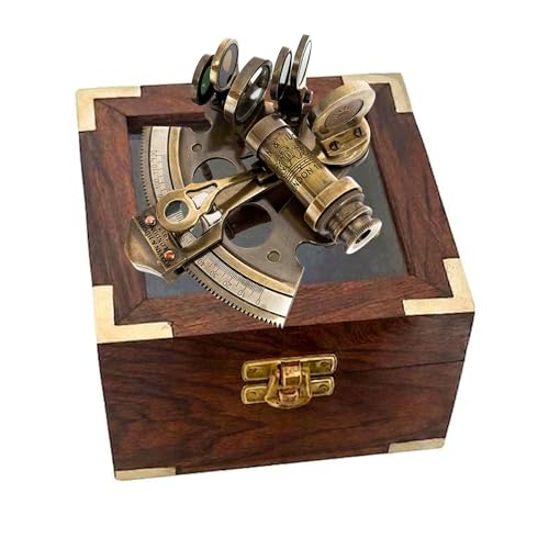
Maritime Antiques Marine Captain Sextant Working Astrolabe Instrument Ship Sextant Marine Pirate Gift with Box
- Brand New, High Quality: Made of Solid Brass
- Fully Functional Sextant: Includes Rosewood Box
- Perfect Gift for All: Nautical Pirate Decor
As an affiliate, we earn on qualifying purchases.
As an affiliate, we earn on qualifying purchases.
Celestial Navigation: A Complete Home Study Course, Second Edition
As an affiliate, we earn on qualifying purchases.
As an affiliate, we earn on qualifying purchases.