TL;DR

Prime made for students and young adults
- Fast, free delivery for dorm and study essentials
- Prime Video and Amazon Music included
- Member-only deals
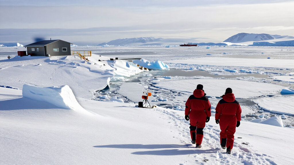
NASA and the National Snow and Ice Data Center say Antarctic sea ice likely reached its 2026 annual maximum on Sept. 14, covering an estimated 17.59 million square kilometers. That is the third-lowest maximum in the satellite record, continuing a pattern of generally below-normal coverage since the sharp declines that began in 2016.
Antarctic sea ice likely reached its 2026 annual maximum on September 14, covering an estimated 17.59 million square kilometers (6.79 million square miles), according to NASA and the National Snow and Ice Data Center. The extent was the third-lowest annual maximum in the satellite record, adding another low-coverage year to a period of reduced Antarctic sea ice since 2016.
The September 14 estimate marks the largest extent observed during the Southern Hemisphere winter this year. NASA’s October 6 update says the annual maximum was likely reached on that date; the figure is an estimate derived from satellite observations, not a direct measurement of every ice-covered area. Antarctic sea ice typically expands through winter and reaches its maximum around September, before retreating toward its summer minimum in February.
Scientists define sea ice extent by counting areas where ice concentration is at least 15 percent. The threshold is commonly used with satellite data, and the total area meeting it is reported as extent. NASA’s comparison maps show monthly average ice concentration for September and the following February from 1990 through 2026. They use passive microwave observations, which can detect sea ice through cloud cover and allow regular monitoring regardless of weather.
The annual maximum is a seasonal measure, distinct from the summer minimum. NASA and NSIDC identify 2023 as the year of both the record-low maximum and record-low minimum. The 2026 maximum is higher than that record low, but still among the three lowest since the satellite record began.
A Low Winter Peak in a Changing Record
The 2026 ranking matters because it adds evidence to a sequence of low Antarctic sea ice measurements, while a single year cannot determine whether the region is undergoing a lasting shift. Sea ice affects the exchange of heat between ocean and atmosphere and forms habitat for animals that depend on ice. Changes in its seasonal area can also influence the conditions around the Antarctic coast and the broader Southern Ocean.
The result is not, by itself, proof of a particular cause or a reliable guide to future ice levels. Antarctic sea ice varies considerably from year to year, and the long-term pattern has not been a simple, steady decline. The 2026 observation is best understood as a notable point in the record: a very low winter peak that scientists will compare with future seasons and other climate measurements.
polar expedition thermal insulated jacket
As an affiliate, we earn on qualifying purchases.
As an affiliate, we earn on qualifying purchases.
From Record Highs to Recent Lows
Antarctica’s geography differs from the Arctic. The Arctic is an ocean basin surrounded by land; Antarctica is a continent surrounded by ocean. That arrangement gives sea ice space to spread outward during the Southern Hemisphere winter, but the expanding ice also reaches warmer latitudes and retreats substantially during summer. The annual cycle generally brings a maximum in September and a minimum in February.
Between 1979 and 2014, Antarctic sea ice extent increased by about 1 percent per decade, NASA reports. The meaning of that trend was uncertain because of strong year-to-year variability. Satellite observations recorded consecutive winter maximum records in 2012, 2013 and 2014, even as Arctic sea ice was declining. The upward run ended in 2015, followed by significant Antarctic sea ice decreases beginning in 2016. There have been small rebounds since then, but coverage has largely stayed below normal.
The satellite record began in late 1978 with observations from NASA’s Nimbus-7. Defense Meteorological Satellite Program satellites contributed data starting in 1987, followed by NASA’s Aqua satellite from 2002 to 2011. Scientists began using observations from Japan’s GCOM-W satellite in 2025. NASA Earth Observatory’s update is part of its World of Change series, which tracks long-term changes using satellite imagery.
satellite imagery weather monitoring device
As an affiliate, we earn on qualifying purchases.
As an affiliate, we earn on qualifying purchases.
The Trend Needs More Seasons
The 2026 peak is described as likely because seasonal maximum timing is determined from satellite observations over time. The supplied report does not give a margin of uncertainty for the 17.59 million-square-kilometer estimate, nor does it identify a cause for this year’s low ranking.
It also remains unclear whether the broader decline since 2016 represents a durable long-term change or a period of unusually low values within a highly variable system. The earlier increase through 2014, the abrupt shift afterward and occasional small rebounds complicate conclusions based on any one season. The report does not provide a 2026 summer minimum, which typically occurs later in the annual cycle.
As an affiliate, we earn on qualifying purchases.
Tracking the February Retreat
Scientists will continue monitoring Antarctic sea ice as it retreats through the Southern Hemisphere summer toward its expected February minimum. That measurement will add information about the full 2026 seasonal cycle, but it is separate from the winter maximum reported here.
Future satellite observations will help establish whether the recent low maxima and minima persist or whether coverage rebounds. NASA and NSIDC’s ongoing monitoring uses a succession of satellite instruments, so continued observations can place each year’s seasonal extent against the record that began in 1978.
thermal insulated water bottle for outdoor
As an affiliate, we earn on qualifying purchases.
As an affiliate, we earn on qualifying purchases.
Key Questions
How large was the 2026 Antarctic sea ice maximum?
It was estimated at 17.59 million square kilometers, or 6.79 million square miles, on September 14, 2026.
How did the 2026 maximum rank?
NASA and NSIDC say it was the third-lowest maximum in the satellite record.
When does Antarctic sea ice usually reach its maximum and minimum?
It usually peaks around September, near the end of the Southern Hemisphere winter, and retreats to a minimum in February.
Does this result prove Antarctic sea ice is in long-term decline?
No. The recent pattern includes years of low coverage, but Antarctic sea ice varies substantially from year to year. Scientists say more observations are needed to determine whether the decline reflects a lasting change or statistical fluctuation.
Source: primary
Columbus Day / Indigenous Peoples' Day Picks
long weekend sales
As an affiliate, we earn on qualifying purchases.


![Competitive Programmer's Handbook (2018) [Pdf]](https://geometr.info/wp-content/uploads/2026/10/competitive-programmer-s-handbook-2018-pdf-featured-560x300.jpg)