RTK drones use advanced GPS correction signals to achieve centimeter-level accuracy, making them essential for precise mapping, surveying, and legal boundary work. Unlike standard GPS drones, they depend on real-time corrections from a base station, ensuring data reliability. When accuracy prevents costly errors, like boundary disputes or detailed infrastructure surveys, RTK technology truly shines. Curious about the specific applications and challenges? Keep exploring to see when and how centimeter precision really matters.
Key Takeaways
- Centimeter accuracy from RTK drones is crucial for boundary delineation, infrastructure development, and legal land surveys.
- Industries like agriculture and construction rely on precise data for crop management, site measurement, and progress monitoring.
- RTK technology reduces errors in mapping and surveying, ensuring high data reliability for sensitive applications.
- Accurate positioning minimizes the need for repeat flights, saving time and optimizing resource use.
- Environmental factors and signal stability impact when centimeter-level precision can be effectively achieved.

SMA20 RTK 900 MHz GPS Surveying Equipment PPK/IMU/NOAA Calibration-free, Connect with UAV/Drone,GNSS Receiver Rover Base Collector Free Permanent Software 1408 Channelsfor Construction and Engineering
Advantages: ①Static &RTK base dual mode,when static surveying simultaneously work as RTK base, enable SMA20 multiple surveying mode…
As an affiliate, we earn on qualifying purchases.
As an affiliate, we earn on qualifying purchases.
What Are RTK Drones and How Do They Achieve Centimeter Accuracy?
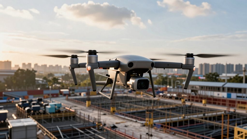
RTK drones are specialized unmanned aerial vehicles equipped with Real-Time Kinematic (RTK) positioning technology that allows them to achieve centimeter-level accuracy. During drone flight, GPS correction signals are essential for precise positioning. RTK systems work by receiving corrections from a base station, which constantly updates the drone’s GPS data in real time. This process reduces errors caused by atmospheric conditions, satellite geometry, and signal delays. As a result, your drone can pinpoint locations with remarkable precision, ideal for detailed mapping, surveying, or construction projects. The combination of advanced GPS correction and real-time data processing ensures that RTK drones deliver consistent, high-accuracy results during every flight, making them invaluable tools in industries where exact positioning is critical. Leveraging European cloud innovation can further enhance data security and processing efficiency for these high-precision applications.
Autel Robotics RTK Module for EVO II Enterprise V2 and V3 Series Drone
ENHANCED PRECISION – Achieve pinpoint accuracy with RTK positioning, offering 1.5cm + 1ppm (Vertical) and 1cm + 1ppm…
As an affiliate, we earn on qualifying purchases.
As an affiliate, we earn on qualifying purchases.
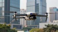
How Do RTK Drones Compare to Standard GPS Drones?
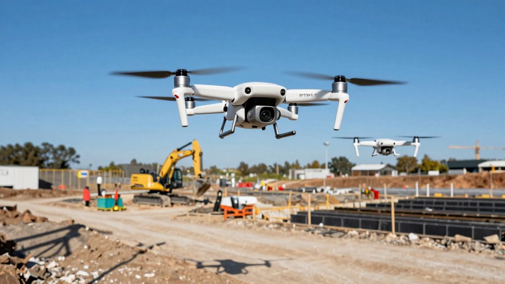
How do RTK drones stack up against standard GPS drones? RTK drones deliver centimeter-level accuracy, making them ideal for precision tasks. Standard GPS drones are more affordable and less complex but offer only meter-level accuracy. This difference impacts their applications and reliability. RTK drones typically require a more powerful drone battery due to extra hardware, and their performance can be limited by weather conditions, like strong winds or heavy rain. Additionally, understanding drone positioning systems helps clarify why these differences matter, especially since accuracy levels directly influence the drone’s ability to perform detailed mapping or surveying tasks.
Autel Robotics EVO II PRO RTK V3, Real-time Centimeter-Level Positioning, Remote ID, S-ony 1'' 6K/30fps HDR Camera, GNSS Base Station & PPK Support, 38 Minutes, 15KM Transmission, for Mapping/Photogrammetry/Urban Planning/Searching
【AUTEL ROBOTICS USA AUTHORIZED】We are the longest and largest distributors of Autel Robotics. Over the years, we have…
As an affiliate, we earn on qualifying purchases.
As an affiliate, we earn on qualifying purchases.
Which Industries Benefit Most From RTK Drone Data?
RTK drone data offers significant advantages for industries that require high accuracy. Farmers use it to optimize crop management, while construction teams rely on precise site measurements. Surveyors and mapping professionals also benefit from its ability to produce detailed, reliable data quickly. Vetted sources ensure that the data collected maintains high quality and trustworthiness, which is crucial for critical decision-making processes. Additionally, the integration of real-time positioning enhances the efficiency and precision of operations in these fields. The use of blockchain data management can further improve data integrity and security in these applications, ensuring that the information remains unaltered and trustworthy. Implementing standardized protocols ensures consistent data quality across different platforms and projects. Moreover, employing data validation techniques helps verify the accuracy and reliability of collected information, which is essential for high-stakes industries.
Precision Agriculture Benefits
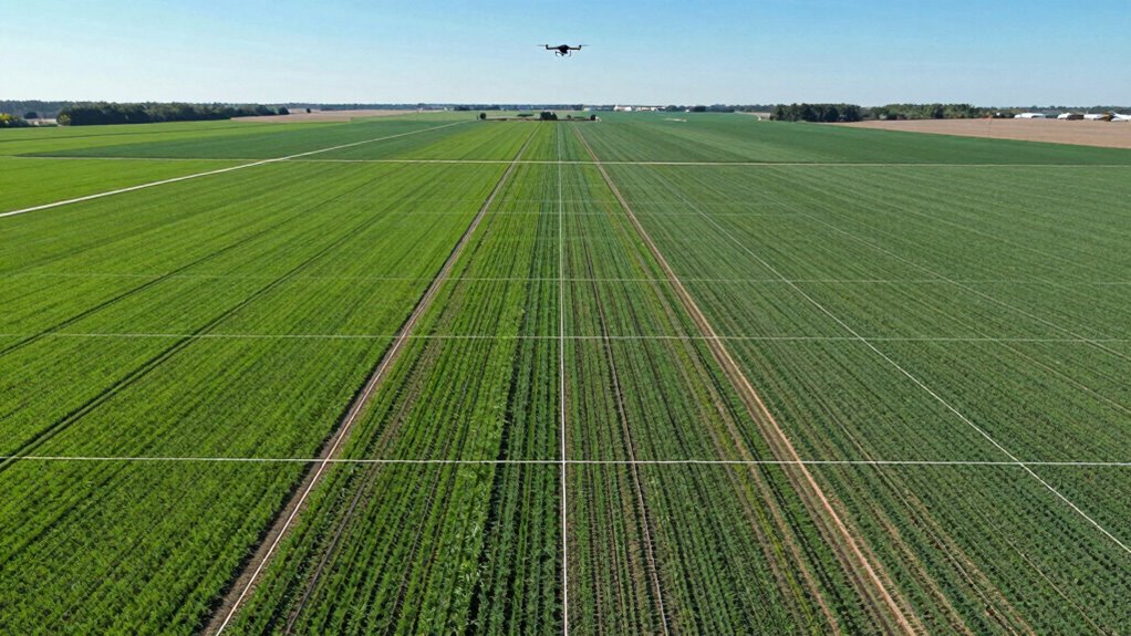
Have you ever wondered which industries gain the most from the precise data provided by RTK drones? In agriculture, centimeter-level accuracy helps you optimize planting, irrigation, and fertilization, leading to higher yields and reduced waste. RTK drones enable detailed field mapping, which supports variable rate application and crop health monitoring. However, you need to stay aware of drone regulations, ensuring your operations comply with local laws. Battery life is another vital factor—farming missions often require extended flight times, so choosing drones with longer-lasting batteries can make a big difference. By leveraging RTK technology, farmers can make more informed decisions, increase efficiency, and boost productivity, making precision agriculture one of the most impactful industries benefiting from this advanced drone data.
Construction Site Accuracy Needs
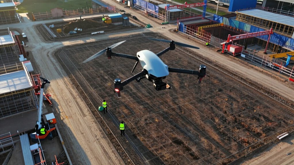
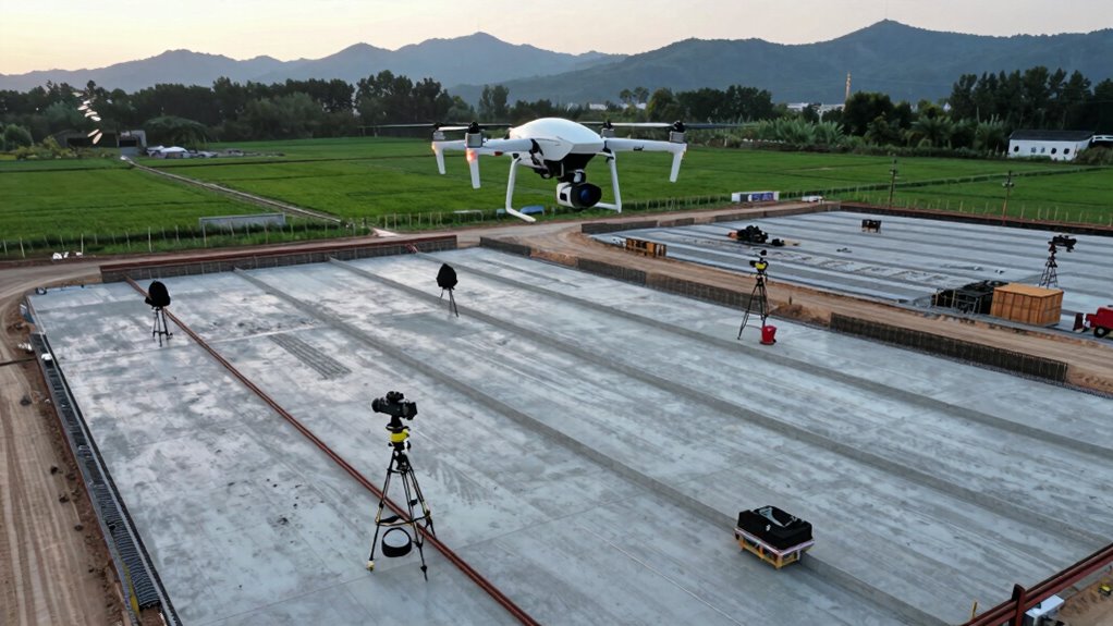
Construction companies increasingly rely on RTK drone data to achieve centimeter-level accuracy in site surveying, mapping, and progress monitoring. This precision benefits industries like urban planning, where exact measurements optimize infrastructure development, and wildlife conservation, where detailed habitat mapping guides protective measures. RTK technology guarantees you can precisely document boundaries, monitor changes, and avoid costly mistakes. Using this data for detailed planning and compliance, reducing delays and rework, is essential for efficient project execution. Additionally, understanding spatial accuracy standards ensures that projects meet regulatory and safety requirements. Awareness of precision measurement techniques further enhances the reliability of data used in critical decision-making processes. Incorporating quality control measures helps maintain data integrity throughout the project lifecycle.
Surveying and Mapping Excellence
Which industries reap the most benefits from RTK drone data when it comes to surveying and mapping? You’ll find agriculture, mining, and environmental management leading the way. RTK drones deliver centimeter-level accuracy, streamlining terrain surveys and reducing field time. This precision minimizes drone maintenance concerns, as frequent adjustments and recalibration are less needed. Longer battery life means you can cover larger areas without frequent landings, increasing efficiency. For mining operations, RTK drones precisely map stockpiles and excavation sites. In environmental projects, they monitor changes with detailed accuracy, supporting conservation efforts. Agriculture benefits from accurate field mapping for precision farming. Understanding RTK technology is key to appreciating its transformative impact. Additionally, the integration of sustainable practices in drone operations ensures minimal environmental impact while maximizing data quality, further benefitting these sectors.

E1 Lite RTK Base Station, High Accuracy GNSS GPS Receiver for Surveying, Drone Mapping & RTK Rover, FCC Certified, Compatible with Third-Party GNSS RTK Receivers (Exclude Tripod)
【High-Precision Surveying】The E1 Lite GNSS RTK delivers centimeter-level accuracy with its full-constellation GNSS support, ensuring reliable performance for…
As an affiliate, we earn on qualifying purchases.
As an affiliate, we earn on qualifying purchases.
When Is Centimeter-Level Accuracy Critical?
If you need pinpoint accuracy for your surveying projects or agricultural mapping, centimeter-level precision becomes vital. This level of accuracy guarantees your data is reliable for tasks like boundary delineation or crop health analysis. Recognizing when this precision matters helps you decide if RTK drones are the right tool for your needs. Modern kitchen technology can also benefit from precise measurements when integrating automated appliances and connected systems. Understanding the importance of accuracy ensures you select the appropriate equipment for your specific project requirements, especially when data reliability is critical for successful outcomes. Additionally, the use of vetted wave and wind techniques can help maintain signal integrity in challenging environments, similar to how controlled measurements are crucial in precise culinary measurements to achieve consistent results.
Precise Surveying Applications
Centimeter-level accuracy becomes essential when your project demands precise positioning and detailed mapping, such as in land parcel delineation, infrastructure development, or infrastructure inspection. Achieving this level of precision guarantees measurements are reliable and compliant with drone regulations, which often mandate high accuracy for certain projects. Precise surveys also help optimize battery longevity, as accurate data reduces the need for repeat flights and corrections. When working on infrastructure inspections, centimeter accuracy allows you to detect even minor structural shifts. For land surveys, it ensures boundary lines are exact, preventing legal disputes. Moreover, these applications often require stable RTK signals and careful planning to meet regulatory standards and maximize drone efficiency. Understanding surveying equipment specifications is crucial to ensure your drone setup can achieve the desired accuracy levels, especially when selecting precision GNSS receivers that are capable of supporting centimeter-level positioning. Additionally, the use of advanced correction data can further enhance the accuracy and reliability of your survey results, making your high-precision tasks more effective. Implementing robust encryption methods can also safeguard sensitive survey data from unauthorized access during transmission and storage.
Agricultural Mapping Needs
When managing large-scale agricultural operations, achieving centimeter-level accuracy becomes essential for tasks like crop monitoring, soil analysis, and precision spraying. With precise mapping, you can detect subtle variations in crop health, identify nutrient deficiencies, and target specific areas for treatment. Accurate data helps optimize water usage, reduce chemical waste, and improve yields. Soil analysis benefits from detailed topography and nutrient mapping, guiding informed decisions on fertilization and irrigation. When accuracy reaches the centimeter level, you gain reliable insights that enhance operational efficiency and sustainability. Without this precision, you risk misallocating resources, missing early signs of crop stress, and making less effective management choices. Centimeter-level accuracy ensures your agricultural mapping delivers actionable, high-quality data for better crop management. Additionally, investing in high-precision equipment like electric road sweepers can help maintain clean and safe farm environments, supporting overall operational efficiency.
What Are the Challenges of Using RTK Drones?
What are the main hurdles you might face when using RTK drones? One challenge is software limitations that can affect data processing, integration, and real-time corrections. If your software isn’t up to date or compatible with your drone, accuracy and efficiency suffer. Regulatory hurdles also pose significant obstacles, as strict rules around drone flights, especially in certain areas, can restrict your operations. Additionally, RTK drones require a stable connection to base stations or correction signals, which can be disrupted by terrain or interference. Other issues include the need for precise calibration and maintaining equipment in the field. Being aware of these challenges helps you plan better and guarantees you get the centimeter-level accuracy that makes RTK drones so valuable. Connected technology plays a crucial role in overcoming some of these hurdles and enhancing overall performance. Moreover, understanding real-time data transmission is essential for maintaining the high precision that RTK systems promise.
Is Investing in RTK Drones Worth It for Your Business?
Investing in RTK drones can substantially boost your business’s efficiency and data accuracy, making them a valuable asset for many industries. However, it’s essential to consider a thorough cost analysis before committing. RTK drones typically come with higher upfront costs compared to standard drones, but their centimeter-level precision can save time and reduce errors in mapping, surveying, and inspections. Keep in mind, drone maintenance is an ongoing expense; regular calibration and repairs are necessary to keep them functioning at their best. If your projects demand high accuracy and frequent data collection, the investment may be well worth it. On the other hand, if your needs are less precise or sporadic, simpler drones might suffice. Weigh the benefits against the costs to determine if RTK technology aligns with your business goals.
Frequently Asked Questions
How Much Do RTK Drones Typically Cost Compared to Standard Drones?
RTK drones typically cost between $7,000 and $20,000, markedly higher than standard drones, which usually range from $500 to $2,000. When considering a cost comparison, you’ll notice that RTK models require a bigger budget but offer centimeter-level accuracy vital for precise tasks. Your budget considerations should factor in how often you’ll need this accuracy, as investing in RTK technology pays off in industries demanding pinpoint precision.
What Are the Training Requirements for Operating RTK Drone Systems?
You need remote pilot certification and advanced navigation skills to operate RTK drone systems safely. While basic drone training covers fundamentals, RTK systems demand specialized knowledge of GPS technology and precise data management. You’ll also need hands-on experience with calibration, troubleshooting, and flight planning to guarantee centimeter-level accuracy. This combination of certification and advanced skills helps you navigate complex environments and meet regulatory standards effectively.
Are There Legal Restrictions on RTK Drone Usage in Different Regions?
You need to be aware of regulatory compliance and regional restrictions when using RTK drones, as laws vary across different regions. Some areas may require permits, restrict certain altitudes, or ban drone flights altogether. It’s your responsibility to research local regulations beforehand, obtain necessary approvals, and follow all guidelines to operate legally. Staying informed guarantees safe, compliant drone use and helps you avoid fines or legal issues.
How Long Do RTK Drone Batteries Typically Last During Missions?
Back in the day, drone batteries lasted forever, but now, with power-hungry RTK tech, you can expect around 20 to 40 minutes of flight time per charge. Battery life varies depending on payload and weather conditions. To maximize your mission, use smart power management, avoid overexerting the drone, and carry spare batteries. Proper power management guarantees you get the most out of each flight without risking a crash.
Can RTK Technology Be Integrated Into Existing Drone Platforms?
Yes, you can integrate RTK technology into existing drone platforms, but you should consider compatibility considerations and integration challenges. Not all drones support RTK modules easily, so verify if your platform’s hardware and firmware are compatible. You might need to update firmware or add specific mounting accessories. Careful planning guarantees smooth integration, allowing you to benefit from centimeter-level accuracy without compromising your drone’s performance or stability.
Conclusion
In the world of drone technology, RTK drones are your precision compass, guiding you through the fog of uncertainty with centimeter-level accuracy. Whether you’re mapping vast landscapes or inspecting delicate structures, they turn your vision into a crystal-clear reality. But remember, like any powerful tool, they come with challenges. Weigh the costs and benefits carefully—because when accuracy truly matters, RTK drones are your trusted allies steering the fine line between precision and possibility.