Understanding datum, benchmarks, and control points is essential for accurate surveying. These concepts provide a reliable coordinate framework, fixed reference marks, and stability for measurements, preventing errors and saving time and money. Proper placement and management ensure data consistency across projects. By mastering these surveying fundamentals, you’ll improve precision and efficiency. Keep exploring these ideas, and you’ll discover how they can greatly enhance your surveying success.
Key Takeaways
- Proper use of datums ensures accurate geographic referencing and reduces positional errors in surveying projects.
- Establishing and verifying stable control points maintains measurement consistency over time.
- Accurate benchmark placement in stable locations supports long-term survey reliability.
- Transforming coordinates correctly between local and global datums prevents data discrepancies.
- Regular verification and documentation of control points and datums enhance project accuracy and efficiency.

Cyiwniao 10 Pack Drone Ground Control Point GCP, 24"x24" Black/WhiteMarkers UAV Aerial Target for Mapping & Surveying (Square Center Eyelet Numbered 0-9)
【BLACK WHITE】Our GCPs are in black and white with strong color contrast to provide optimal visibility in bright…
As an affiliate, we earn on qualifying purchases.
As an affiliate, we earn on qualifying purchases.
What Is a Geodetic Datum and Why Is It Essential?
A geodetic datum serves as the foundational reference framework for mapping and surveying, providing a precise coordinate system to locate points on Earth’s surface. Without it, your measurements would lack consistency and accuracy. Geodetic datums establish a common reference point, ensuring that data from different surveys align correctly. They account for Earth’s shape, size, and gravitational variations, which helps improve survey accuracy. Understanding datums is essential for interpreting geographic data accurately. By using a reliable datum, you can confidently compare, analyze, and integrate geographic data. This consistency is crucial for engineering projects, navigation, and geographic information systems. Essentially, geodetic datums form the backbone of precise mapping, making sure your measurements are accurate and dependable across various applications and locations. Additionally, reference systems built on datums facilitate integration of diverse geographic datasets, further supporting complex surveying and mapping tasks.

An Introduction to Geodetic Reference Systems for Land Surveys
As an affiliate, we earn on qualifying purchases.
As an affiliate, we earn on qualifying purchases.
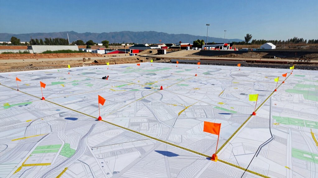
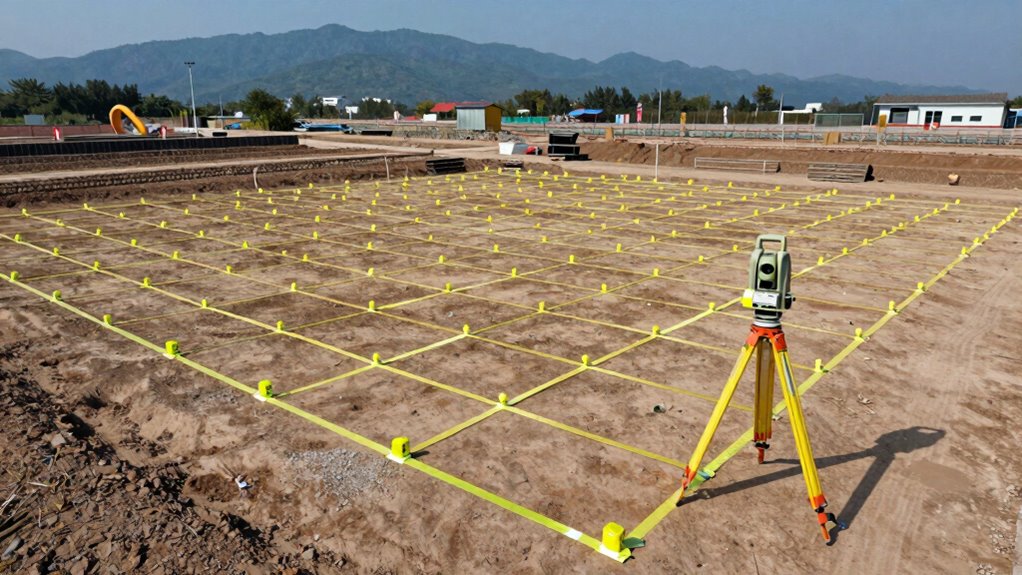
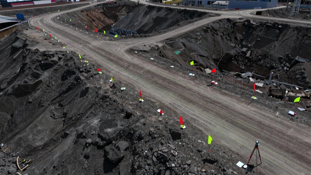
What Are Control Points and How Do They Support Surveying?

Control points establish a consistent geographic reference that surveyors rely on. They help guarantee measurement accuracy across different projects and locations. By using control points, you can confidently tie your work to a reliable framework.
Establishes Geographic Reference
Establishing a geographic reference is essential for ensuring that survey data aligns accurately with real-world locations. This is achieved through control points, which serve as fixed landmarks tied to coordinate systems. These points, often marked by survey markers, provide a reliable framework for all measurements. They act as anchors, helping you maintain consistency across the project. Consider the following emotional impact:
| Confidence | Precision | Stability |
|---|---|---|
| Trust your measurements | Accuracy at every step | Projects held together |
Ensures Measurement Accuracy
Control points play a vital role in maintaining measurement accuracy throughout your surveying work. They serve as fixed references that guarantee your measurements stay precise, adhering to established measurement standards. By anchoring your data to these stable points, you reduce errors caused by equipment or environmental factors. Properly established control points enable you to cross-check data, improve consistency, and ensure interoperability across different surveying technology. They also help in detecting deviations early, saving time and resources. To maximize their effectiveness, assure control points are accurately placed, clearly marked, and regularly verified. This foundation guarantees your entire project maintains high standards of accuracy, ultimately saving you from costly mistakes or rework. When you understand their importance, control points become your trusted allies in precise surveying.
survey benchmarks and control points
As an affiliate, we earn on qualifying purchases.
As an affiliate, we earn on qualifying purchases.
How to Establish a Reliable Geodetic Datum Step-by-Step
Creating a reliable geodetic datum begins with careful planning and precise measurements. Start by selecting stable control points, ensuring they are well-documented and accurately located. Next, perform a coordinate transformation to align local survey data with a recognized global system, accounting for any datum shift that might occur. This step is critical to minimize discrepancies between your local datum and the geodetic reference. Use high-precision instruments and verify measurements through repeated observations. Establish a network of control points that will serve as benchmarks for future surveys. Consistent data collection and careful adjustment of the control network ensure the datum’s stability. Additionally, understanding geodetic datums is essential for ensuring the accuracy and reliability of your survey data over time. Employing vetted methods and tools can significantly improve the precision of your measurements and overall project outcomes. Regular calibration of equipment and validation of results can further enhance the reliability of your survey data. By systematically addressing coordinate transformation and datum shift, you create a dependable foundation for all subsequent surveying activities. Incorporating advanced surveying techniques can also help detect and correct potential errors early in the process.

ZL660 Land Surveying Equipment, Intuitive Operation Handheld GPS for Surveying with 6 Satellites, 3.2" Color Screen,7 Methods for Measuring Land Area, Distance,Slope and Save Coordinates Point
High-Precision Surveying & Portable: Take professional-grade surveying anywhere. Supports 6 satellite systems for fast, reliable positioning(area error<0.002 acres,…
As an affiliate, we earn on qualifying purchases.
As an affiliate, we earn on qualifying purchases.
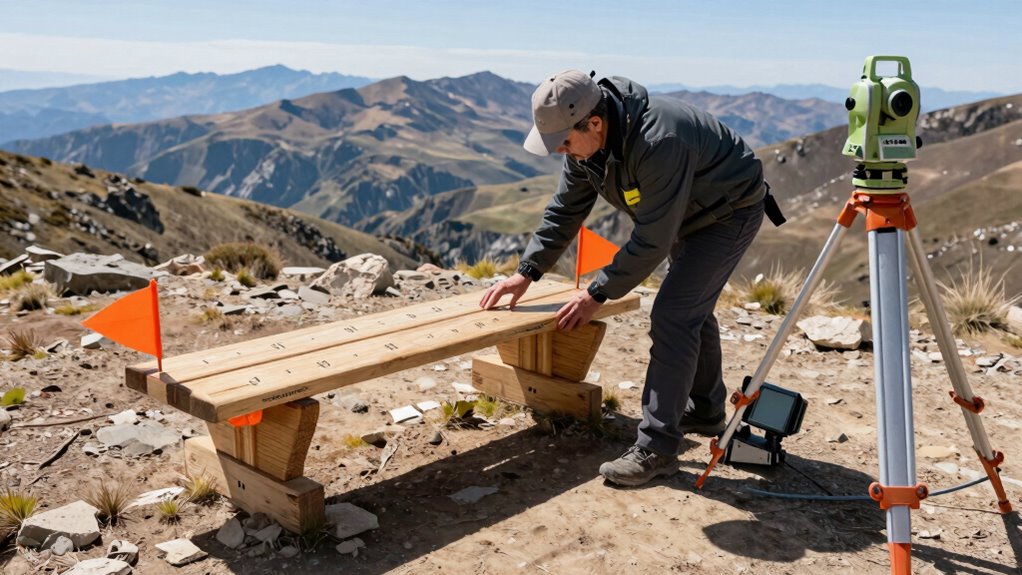
How to Choose and Use Benchmarks for Your Project
When selecting benchmarks, you need to guarantee they are stable, accurately located, and accessible for future reference. Proper placement involves choosing high-visibility spots that won’t be disturbed or affected by construction activities. Additionally, incorporating sustainability practices into the placement process can help ensure the longevity and minimal environmental impact of the benchmarks. Ensuring that benchmarks are well-researched and reliable is essential for maintaining accuracy over the course of the project. Using reliable power sources such as backup generators can prevent disruptions that might compromise survey equipment or data collection. Implementing field-of-view considerations can also improve the visibility and accessibility of benchmarks in various environments. Emphasizing creative storytelling can also enhance stakeholder engagement and support for the project. By carefully choosing and placing benchmarks, you set a solid foundation for precise and reliable surveying throughout your project.
Selecting Appropriate Benchmarks
Choosing the right benchmarks is crucial for guaranteeing your surveying project is accurate and reliable. Your selection impacts the entire process, especially when performing coordinate transformation or datum shifting. You need benchmarks that are stable, well-documented, and tied to a recognized datum. Consider the project’s geographic scope and precision requirements to match benchmarks accordingly. Accurate benchmarks prevent errors that could cascade through your data. Remember, the right benchmarks simplify coordinate transformation, reducing the risk of misalignment. They also support consistent datum shifting, ensuring your data aligns correctly with existing maps or control points. Additionally, selecting benchmarks with easy document management helps keep your project organized and accessible throughout its duration.
Proper Benchmark Placement
Proper placement of benchmarks guarantees the accuracy and reliability of your surveying project from the outset. To achieve this, you must carefully select locations that are stable, accessible, and protected from disturbances. Proper benchmark calibration ensures your reference points remain precise over time, so regularly verify and adjust benchmarks as needed. During surveyor training, emphasize best practices for identifying most suitable sites and documenting their positions clearly. Avoid placing benchmarks in areas prone to shifting, erosion, or construction activity. Consistent, strategic placement reduces errors and simplifies future measurements. Remember, well-placed benchmarks serve as the foundation of your project, enabling accurate data collection and minimizing costly corrections later. Prioritize quality and stability in your benchmarks to ensure long-term project success. Additionally, understanding the importance of geodetic control points can significantly enhance the stability and accuracy of your survey network. Incorporating proper benchmark placement techniques is essential for reducing measurement errors and ensuring data integrity throughout the project lifecycle. Recognizing the role of survey monument stability can further improve the longevity and precision of your benchmarks. Moreover, selecting sites with minimal ground movement or disturbances helps maintain the integrity of your survey network over time. Using appropriate site selection methods can further ensure that benchmarks remain reliable under various environmental conditions.
Common Datum Errors and How to Prevent Them

One common mistake in surveying is using an incorrect or inconsistent datum, which can lead to significant positional errors. These datum discrepancies often cause control point errors that compromise project accuracy. To prevent this, you should:
Using inconsistent datums risks large positional errors and control point inaccuracies in surveying.
- Always verify the datum used against project specifications
- Cross-check control points for consistency
- Document datum transformations clearly
- Regularly update survey data with the latest geospatial info
- Avoid mixing different datums without proper conversion
Integrating Local and Global Datums for Large-Scale Surveys

When integrating local and global datums in large-scale surveys, it’s important to recognize the differences in coordinate systems and reference frameworks. Local datums are tailored to specific regions, offering high accuracy within their areas but often lacking global compatibility. Global datums, like WGS84, provide a unified reference system suitable for worldwide applications. To guarantee seamless integration, you must transform local datum coordinates into a compatible global framework, often using transformation parameters or specialized software. This process guarantees that data from various sources aligns correctly, avoiding discrepancies that could compromise project accuracy. Achieving proper integration enhances the overall reliability of your survey, ensuring that local detail and global consistency work together effectively. Additionally, understanding the Suprem fabric composition can inform the selection of materials for survey equipment and garments used in fieldwork, ensuring durability and comfort in various environments.
Why Correct Control Point Placement Saves Time and Money

Accurate placement of control points is essential because it sets the foundation for the entire survey. Properly positioned control points ensure control point stability, reducing the risk of shifts that can compromise data integrity. Correct placement streamlines datum transformation, minimizing errors and saving time during data processing. When control points are well-placed, re-surveys and adjustments become less frequent, saving money. Additionally, using stable and accurately located control points reduces the need for multiple remeasurements, which can delay projects. Proper control point placement supports seamless integration of local and global datums, avoiding costly corrections later. Incorporating geodetic principles in planning can further enhance the reliability and accuracy of control networks, ultimately leading to more consistent project outcomes. Furthermore, understanding control point stability helps in maintaining long-term survey accuracy and reduces maintenance efforts.
Troubleshooting Datum and Control Point Misalignments
Have you ever encountered a misalignment between your survey data and the established datum or control points? When this happens, you face potential datum discrepancies and control point errors that threaten project accuracy. To troubleshoot, first verify your control points’ coordinates against original records. Next, check for calculation mistakes or instrument setup errors. Revisit your survey procedures to ensure proper calibration. Use this table to understand common issues:
| Issue | Solution |
|---|---|
| Datum discrepancies | Recalculate using reliable control points |
| Control point errors | Re-survey or adjust control point locations |
| Instrument misalignment | Calibrate and verify instrument setup |
Address these problems promptly, re-establish your control points if needed, and confirm your data aligns with the correct datum to keep your project on track. Incorporating accurate measurement techniques can further improve survey reliability and prevent similar issues. Additionally, understanding the role of surveying principles can help in diagnosing and resolving these types of problems more effectively. Recognizing the importance of reference system fundamentals ensures your data remains consistent across different survey tasks.
Final Tips for Accurate and Efficient Surveying

Ensuring your survey data is both accurate and efficient requires attention to detail and disciplined procedures. Follow strict surveying ethics to maintain integrity and professionalism throughout your project. Regular equipment calibration is essential to prevent measurement errors and ensure reliable results. Plan your survey carefully, double-check control points, and verify data consistency. Use proper data management to avoid mistakes and streamline processes. Maintain clear documentation of procedures and calibrations for accountability. Stay focused on precision and avoid shortcuts that could compromise accuracy. Communicate clearly with your team to coordinate efforts. Remember, disciplined practices and respect for ethical standards safeguard your project’s success.
- Prioritize equipment calibration for accuracy
- Uphold surveying ethics at every step
- Double-check control points regularly
- Document procedures meticulously
- Plan thoroughly to save time and resources
Frequently Asked Questions
How Do Surveyors Verify the Accuracy of Control Points in the Field?
You verify control points in the field by performing GPS calibration and field verification. First, you use GPS equipment to check the precise location of control points, ensuring the data aligns with known coordinates. Then, you conduct field verification by re-measuring the points with total stations or other tools, comparing the results to the original data. This process helps confirm the accuracy and reliability of your control points before proceeding with the project.
What Are the Impacts of Datum Shifts on Construction Projects?
Datum shifts can considerably impact your construction project by affecting geodetic consistency and coordinate accuracy. When a datum shifts, your site measurements may no longer align with original plans, leading to errors in positioning. To mitigate this, you need to perform coordinate transformations to realign data correctly. This ensures your project remains precise, reducing costly mistakes and delays caused by misaligned survey data.
How Often Should Benchmarks Be Recalibrated or Verified?
You should verify benchmarks regularly, ideally every few months or after significant construction events. Routine benchmark calibration ensures measurements stay accurate, preventing costly errors. Control point verification is vital whenever there’s suspicion of movement or disturbance, which can compromise project integrity. Consistent checks help maintain precise positioning, safeguarding your project’s success. Staying proactive with these verifications minimizes delays and ensures all survey data remains reliable throughout the project lifecycle.
Can a Single Survey Project Use Multiple Datums Simultaneously?
Yes, you can use multiple datums in a single survey project, but it requires careful coordinate transformations to guarantee accuracy. You’ll need to convert data from one datum to another, which involves applying precise mathematical transformations. This process helps align different datasets, especially when integrating new surveys with existing maps. Just make sure to document all transformations thoroughly to maintain data integrity throughout the project.
What Technology Advancements Are Improving Datum and Control Point Accuracy?
Imagine you’re upgrading your surveying toolkit with cutting-edge technology. GNSS advancements act like a GPS compass, guiding you with pinpoint precision. Real-time corrections stream data instantly, sharpening accuracy like a lens focusing on clarity. These innovations transform your work, making control points more reliable and datums more precise. By harnessing these tools, you guarantee your project’s foundation stays solid, no matter how complex or distant the terrain.
Conclusion
By understanding and correctly using datums, control points, and benchmarks, you can boost your surveying accuracy. Did you know that improper datum setup can cause errors of up to several meters? That’s why precision matters. When you carefully establish and verify these elements, you’ll save time, reduce costly mistakes, and ensure your project’s success. Master these concepts, and you’ll navigate surveying challenges with confidence and efficiency.